

Latest Weather Blog
Thursday PM Forecast: heat warnings to end week, tropical system targets eastern Gulf
An *EXCESSIVE HEAT WARNING* is in effect from 10am to 7pm Friday as feels-like temperatures up to 115 degrees are expected across the entire Storm Station Forecast Area. Hot temperatures and high humidity may cause heat illnesses. Drink plenty of fluids, and when possible, stay in an air-conditioned rooms, avoid afternoon sun, and check up on relatives and neighbors.
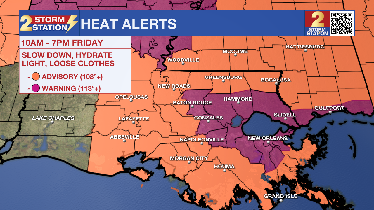
Tonight & Tomorrow: Skies will gradually clear overnight with well above average low temperatures continuing. The standing record warm minimum is 80 degrees and most locations will not drop below that. Friday may turn out to be the hottest of the workweek. With just a few clouds, sunshine will bake high temperatures into the upper 90s, with one or two spots possible hitting 100 degrees. The heat index will certainly be well over 100 degrees, as high as 115 degrees during the mid-afternoon and so only spend time outside safely.
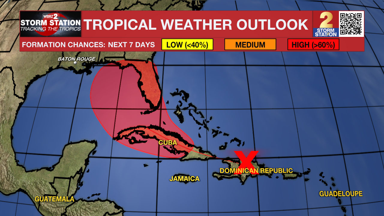
Up Next: Over the weekend, the atmosphere may cool just marginally enough to introduce a slight uptick in the number of showers and thunderstorms that can pop, but coverage will still only be isolated. Temperatures may slide by a degree or two—not much. The early expectation for next week is more of the same with big heat and low end rain coverage. However, the Sunday – Monday forecast will hinge upon the behavior of a tropical system expected to be in the eastern Gulf of Mexico. While direct impacts appear unlikely, on the western side of this system there may be some drier and (relatively) cooler air pulled into the Capital Area. The sensible effects on local weather would be a slight drop in humidity and rain chances back to about nil. More clarity and detail to the forecast is expected over the weekend, so continue to check in with the Storm Station.
Trending News
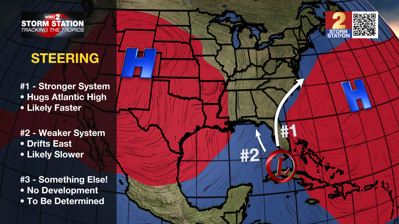
The Tropics: A well-defined tropical wave is producing a large area of disorganized showers and thunderstorms over Hispaniola, Puerto Rico, the Southeastern Bahamas, and the adjacent waters of the southwestern Atlantic and northeastern Caribbean Sea. Development of this system should be slow to occur during the next day or so while it moves west-northwestward over portions of the Greater Antilles. However, environmental conditions are forecast to be more conducive for development after the wave passes the Greater Antilles, and a tropical depression is likely to form this weekend or early next week over the eastern Gulf of Mexico near the Florida Peninsula.
Get the latest 7-day forecast and real time weather updates HERE.
Watch live news HERE.
– Josh
The Storm Station is here for you, on every platform. Your weather updates can be found on News 2, wbrz.com, and the WBRZ WX App on your Apple or Android device. Follow WBRZ Weather on Facebook and Twitter for even more weather updates while you are on the go.
More News
