

Latest Weather Blog
Thursday PM Forecast: frosty night followed by steady warming, next rain in sight
Calming winds overnight will ease the fire danger across southern Louisiana and southwest Mississippi. Attention will briefly turn to the potential for some frost into Friday morning.
Tonight Through Saturday: Chilly air will continue to settle in with lows dipping into the 30s and 40s—so bundle up if you're heading out early tomorrow morning. Some patchy frost may even develop in the more sheltered river basins and rural areas, especially north and east of Baton Rouge. If you have sensitive tropical plants, you may want to move or cover them.
A strong high-pressure system will dominate the weather on Friday with clear skies and low humidity. These conditions will result in a fast recovery for temperatures with afternoon highs hitting the low 70s.
By Saturday, warmer air begins returning from the Gulf, pushing highs into the upper 70s to and low 80s. While a few clouds may form during the afternoon, the air will remain too dry for rain. Overnight, lows will stay milder, only dipping into the upper 50s and lower 60s.
Trending News
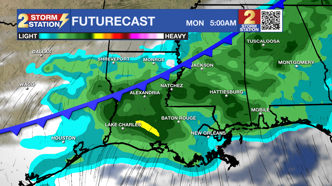
Up Next: Sunday will feature more warm temperatures but with increasing cloud cover. It is important to note that daylight hours will stay mainly dry. However, a cold front will slide into the region increasing rain coverage late Sunday night into Monday morning. While deep moisture will be present to support thunderstorms, energy will be limited, which should keep severe weather chances low. Expect occasional rain showers and breezy conditions through Monday morning.
After wet weather, a surface high-pressure system will visit, drying things out Tuesday through Wednesday. The front is not expected to make a clean pass through the area so temperatures will not fall much with highs in the upper 70s and low 80s midweek.
Get the latest 7-day forecast and real-time weather updates HERE.
Watch live news HERE.
– Josh
The Storm Station is here for you, on every platform. Your weather updates can be found on News 2, wbrz.com, and the WBRZ WX App on your Apple or Android device. Follow WBRZ Weather on Facebook and X for even more weather updates while you are on the go.
More News
