

Latest Weather Blog
Thursday PM Forecast: few rounds of showers and thunderstorms through Monday
The Baton Rouge Area will move into an unsettled weather pattern over the next several days, with two rounds of rain that could impact weekend plans, including LSU Baseball games. Of the two weekend afternoons, Sunday looks much more cooperative. Keep the Storm Station Weather App handy for rain and lightning alerts!
Here’s a breakdown of what to expect:
- Friday night into Saturday morning: Off and on heavy rain and spotty strong thunderstorm
- Saturday afternoon & evening: Gradual clearing
- Sunday: Mostly dry and warm—best day for outdoor plans
- Sunday night into Monday: Another round of storms, possibly strong
- Tuesday to Thursday: Warming up, mostly dry, becoming breezy
Tonight through Saturday: Mainly cloudy skies will persist overnight. Increasing southeast winds will hold low temperatures in the mid-60s. Friday will be breezy and warm with highs in the upper 70s. As we head into the evening, a storm system will move in from the west. From Friday afternoon through Saturday morning, clusters of rain and thunderstorms will move through the area. The rain is not expected to be constant but could be heavy at times leading to isolated street and poor drainage flooding. Overall, 1-3 inches of rain is anticipated, but a point location could receive more. A storm with gusty wind or hail is also not out of the question.
Trending News
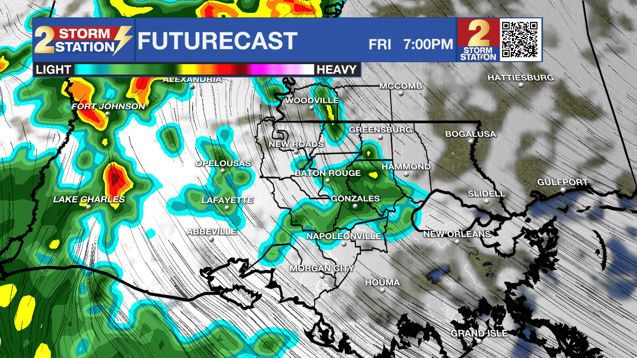
If you have Friday night plans, especially outdoors, consider moving them inside or keeping a close eye on the radar. Drive with caution in any downpours.
Up Next: By Saturday afternoon, rain chances will start to decrease, though some lingering showers are possible. The temperature will still be mild, topping out around 80°. Conditions should be improving for LSU Baseball to eventually play. Sunday looks like the best day of the weekend for outdoor activities. A spotty shower or thunderstorm remains possible, but overall, it will be warm and partly sunny, with highs climbing to the mid-80s.
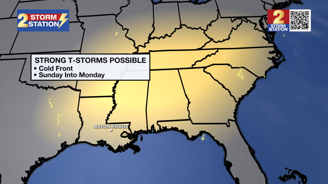
A frontal system will then move in late Sunday night into Monday. This round of storms could be stronger than the first, with the potential for more heavy rain, gusty winds, and even an isolated tornado. Monday morning’s commute could be tricky, so plan accordingly.
After Monday’s storms, things start to calm down. Tuesday looks sunny with highs in the mid-80s, while Wednesday and Thursday will be even warmer, climbing into the upper 80s. The next front will arrive toward the end of next week.
Get the latest 7-day forecast and real-time weather updates HERE.
Watch live news HERE.
– Josh
The Storm Station is here for you, on every platform. Your weather updates can be found on News 2, wbrz.com, and the WBRZ WX App on your Apple or Android device. Follow WBRZ Weather on Facebook and X for even more weather updates while you are on the go.
More News
