

Latest Weather Blog
Thursday AM Forecast: Trading storms for heat this weekend
The rounds of storms come to an end today as a shift in upper-air pattern allows for drier, and much warmer days ahead.
Today & Tonight: Morning conditions will be a bit groggy as temperatures in the Capital Area have only dropped into the upper-70's with mostly cloudy skies and humid air. A weak front sitting across northern Louisiana early Thursday morning will seep south throughout the day. As it does, we cannot rule out a spotty shower or storm associated with it. Once it moves through, clearing skies and a push of drier air will cut off rain chances as we head towards the weekend. Temperatures this afternoon in response to more sunshine will warm into the low-90's in the metro area. Peak feels-like temps will near 100° today.
Overnight, as clear conditions and light northerly winds take over, temperatures will fall into the low and mid 70's around the state.
Trending News
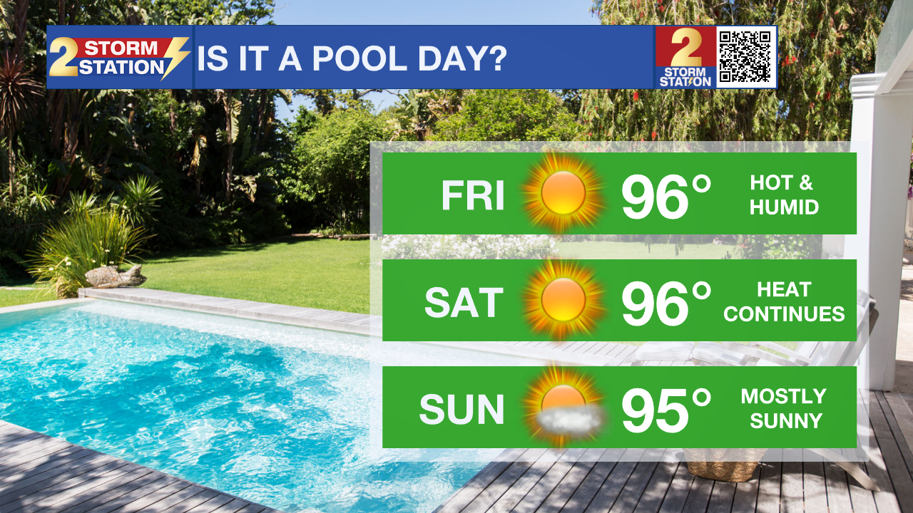
Up Next: Thanks to ridging taking over the area in the upper-atmosphere by Friday, a "heat dome" will make itself known across much of the south-central United States. We will notice this change in weather pattern most by the lack of rain chances, extra-sunny conditions, and HOT afternoon temperatures over the weekend. Though morning lows will still begin in the 70's, afternoon temperatures will likely climb 20°+ Friday through Sunday. Afternoon high's in the Capital Area will reach into the mid-90's during peak daytime heating hours, with humidity adding an extra zing, resulting in feels like temperatures above 100°.
The next workweek brings another weak cold front to the area between Monday and Tuesday. As this front moves through, conditions will be suitable for a few isolated storms. Long-term data suggests a minor cool down will be arriving with this front, likely sending temperatures in the afternoons closer to average for the second week of June, which is 90°.
The Tropics: For the Gulf of Mexico, Caribbean Sea and North Atlantic Ocean, all is quiet. No tropical development is expected over the next seven days.
Get the latest 7-day forecast and real time weather updates HERE.
Watch live news HERE.
- Emma Kate Cowan
More News
