69°
Baton Rouge, Louisiana
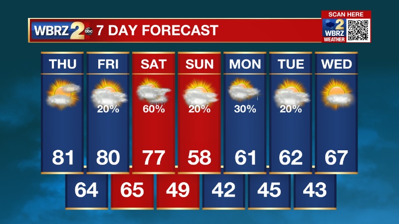
7 Day Forecast


Latest Weather Blog
Thursday AM Forecast: Temperatures approach record highs today
0 seconds of 0 secondsVolume 90%
Press shift question mark to access a list of keyboard shortcuts
Keyboard Shortcuts
Shortcuts Open/Close/ or ?
Play/PauseSPACE
Increase Volume↑
Decrease Volume↓
Seek Forward→
Seek Backward←
Captions On/Offc
Fullscreen/Exit Fullscreenf
Mute/Unmutem
Decrease Caption Size-
Increase Caption Size+ or =
Seek %0-9
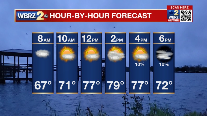
The Forecast:
Expect a mix of sun and clouds this afternoon with high temperatures in the upper 70s and low 80s. The record high for Baton Rouge today is 82.
Tonight, patchy fog is likely. That is something to look out for Friday morning.
Looking Ahead:
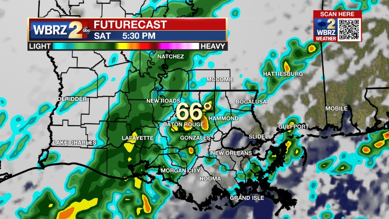
A cold front will move through the area Saturday afternoon, bringing widespread showers and a few thunderstorms. Once the front passes, temperatures will drop quickly. In fact, Sunday we will struggle to get out of the 50s. The cooler weather will stick around through mid-week, before we see a quick warm up by Christmas Eve and Christmas Day.
You can always get the forecast and a look at current radar on the free WBRZ WX app!
More News
Radar
7 Days
