

Latest Weather Blog
Thursday AM Forecast: Heat Alerts continue as students head back to school
A *HEAT ADVISORY* will be in effect from 10am to 7pm Thursday for the 11th consecutive day as feels-like temperatures top out at or above 108° across the entire Storm Station Forecast Area. Hot temperatures and high humidity may cause heat illnesses. With school back in session for many, make sure to send students with water bottles and stress the importance of drinking plenty of water throughout the day.
Today & Tonight: As many students around the Capital Area head back to school Thursday, the heat presses on. Conditions by the school bus early Thursday morning will be mild and muggy with temperatures in the upper-70's. Just in time for afternoon pick-up or after school practices, the heat will be on full blast with high temperatures near 99°. Anyone spending excess amounts of time out doors today will need to prioritize extra hydration and keeping cool as feels like temperatures will exceed 108° at points Thursday afternoon. We will see plenty of sunshine today with only a few clouds around this afternoon.
Conditions remain dry and clear into the overnight as temperatures will return to the mid and upper-70s by early Friday.
Up Next: Into the weekend, the hot and dry pattern will continue. Expect morning lows in the upper-70's and hot afternoons in the upper-90's. We will likely see the streak of heat alert days continue as feels-like temperatures will return to or above 108° each afternoon. Friday and Saturday will feature plenty of sunshine and mainly dry conditions while Sunday looks to carry a few more clouds and a spotty shower or two. We may see a slight decline in humidity during the the weekend but it will quickly return by next week.
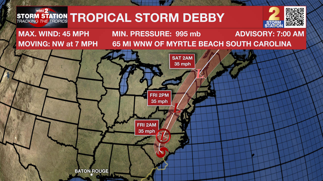
The Tropics: Early Thursday morning, Tropical Storm Debby made a second landfall in the United States in South Carolina. The storm moves at a very slow 5mph crawl with maximum sustained winds near 50 mph. Debby will continue to bring heavy rains to the Carolina's and West Virginia on Thursday. The storm will finally gain some momentum as it continues to lose strength and move through the New England area over the weekend.
Trending News
The National Hurricane Center has highlighted a new area of potential tropical development in the Atlantic Ocean. As of now, this group of disorganized showers and thunderstorms holds a low (30%) chance of developing any tropical characteristics over the next 7 days, but the Storm Station will continue to monitor it.
Get the latest 7-day forecast and real time weather updates HERE.
Watch live news HERE.
- Emma Kate C.
The Storm Station is here for you, on every platform. Your weather updates can be found on News 2, wbrz.com, and the WBRZ WX App on your Apple or Android device. Follow WBRZ Weather on Facebook and Twitter for even more weather updates while you are on the go.
More News
