

Latest Weather Blog
Thursday AM Forecast: final days of August feature elevated rain coverage thanks to tropical moisture
Deep tropical moisture continues to sit over southern Louisiana, motivating shower and storm development to roll through the Capital Area in waves in the coming days. Heavy downpours are possible but the risk for flooding remains low at this time.
Today & Tonight: Thursday morning conditions will again be quite muggy with high humidity and warm morning temperatures. Sunshine early in the day will warm temperatures into the lower-90's before mainly cloudy conditions take over during afternoon hours. Another round of scattered to numerous showers and storms is set to move up from the gulf and across the region during afternoon hours, mainly between 1-5pm Thursday. Some brief, heavy downpours and lightning could make outdoor plans and/or driving conditions unfavorable. Any lingering storms will continue to move out of the Capital Area through the evening hours leaving behind rain-cooled air in the 80's. Overnight, temperatures will slowly decline back to the upper-70s under mostly cloudy skies.
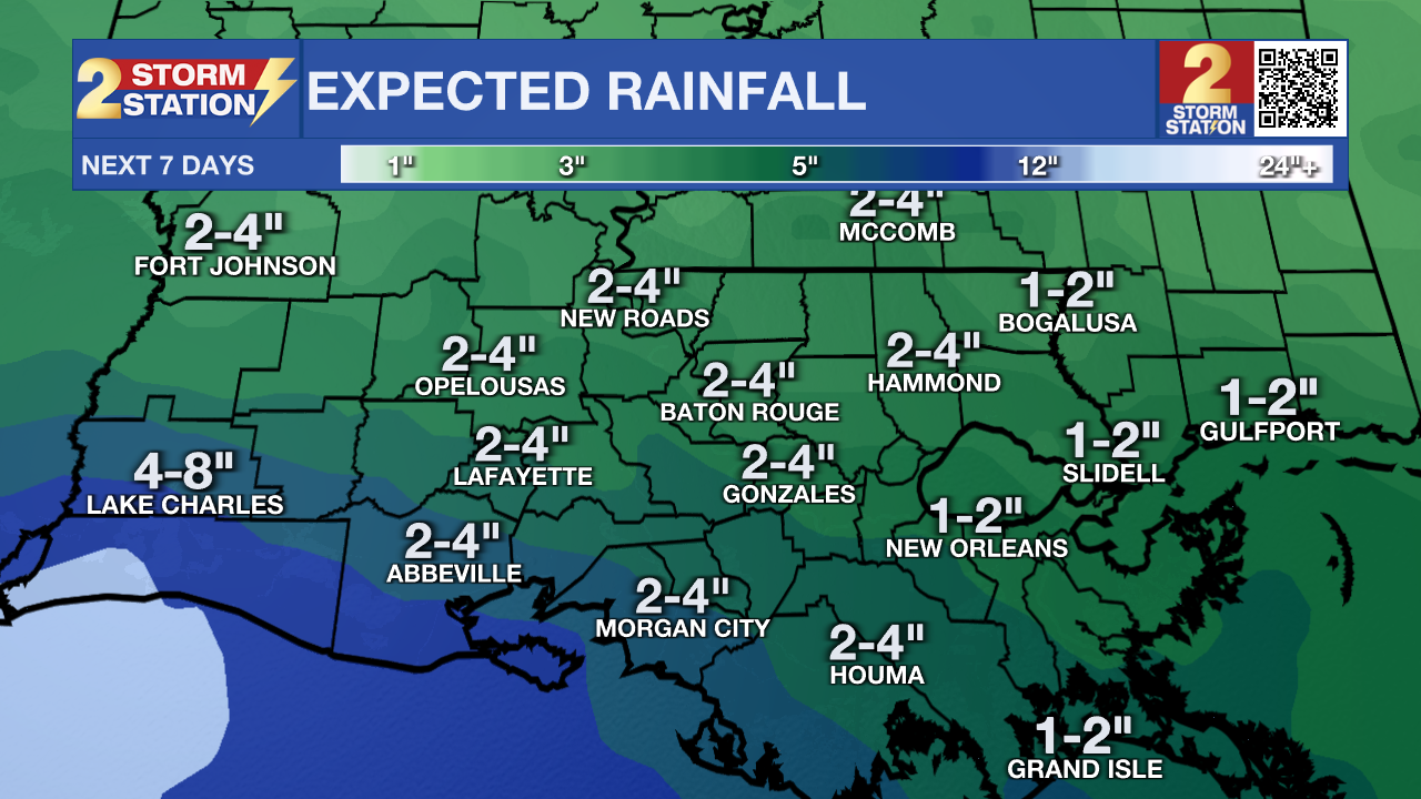
Up Next: Friday will feature the least amount of sunshine of the week, resulting in afternoon temperatures sub-90 degrees for the first time in a while! There will be plenty of dry time during the day, especially in the morning hours, but yet another round of showers will be motivated to move through southern Louisiana Friday afternoon thanks to the adequate amount of moisture in the atmosphere. Over the weekend, temperatures will near 90° each day with hit-or-miss showers possible on Saturday and isolated activity Sunday. There will still be plenty of dry time throughout the weekend and even some sun on Sunday. Labor Day is trending a bit drier, with only an isolated chance for pop-up storms as the plume of tropical moisture exits the region. Over the next week, most parishes and counties will accumulate 2-4" of beneficial rainfall, even while not seeing rain every day.
If you have plans for the Labor Day Weekend, nearby coastal communities will have similar weather to the Baton Rouge area. Be alert to darkening skies as it could signal thunderstorms. Lightning could chase you inside briefly, but do not expect any washouts. For LSU Football fans traveling to Las Vegas it will be downright hot. Afternoon temperatures on gameday will soar well into the 100s and postgame temperatures will still be in the 90s.
Trending News
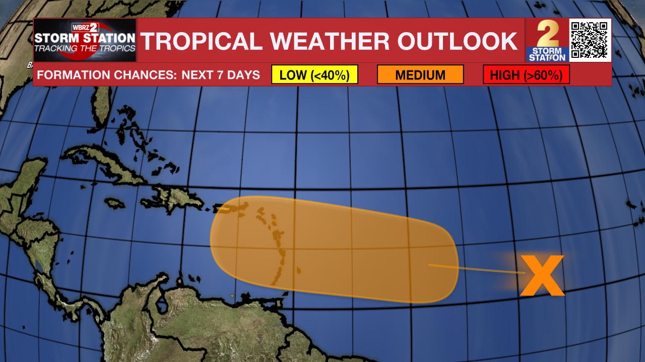
The Tropics: An area of disorganized showers over the central Tropical Atlantic is associated with a tropical wave. Some development of this system is expected in the coming days and it currently holds a medium (40%) chance of developing tropical characteristics over the next 7 days.
Get the latest 7-day forecast and real time weather updates HERE.
Watch live news HERE.
– Emma Kate C.
The Storm Station is here for you, on every platform. Your weather updates can be found on News 2, wbrz.com, and the WBRZ WX App on your Apple or Android device. Follow WBRZ Weather on Facebook and Twitter for even more weather updates while you are on the go.
More News
