

Latest Weather Blog
Sunday PM Forecast: Seasonable temperatures, rain limited this week
This week, the capital area will experience a quiet stretch of weather typical of mid-September. It will be warm, a bit muggy, with pop-up storms on a few occasions.
Tonight & Tomorrow: With only a few evening and overnight clouds, things should remain fairly quiet into Monday morning. Morning lows will be in the lower-70s. A few of communities north of the interstate might manage to dip into the upper-60s. Monday will feature a mixture of clouds and sun. It should be another warm one with a high near 90°. Even with plenty of humidity, afternoon feels-like temperatures will below 100°.
Rain chances aren't impressive, but they aren't zero either. A spotty storm or two cannot be ruled out throughout the course of the day. As time progresses into the evening, spotty storms might hang around for a little longer than usual. This will be in response to an upper-level disturbance (associated with what's left over of Francine) pushing some additional moisture into the region. But even so, overall rain coverage remains spotty to isolated.
Up Next: Leftover moisture on Tuesday could support spotty showers once again. The area will otherwise be dry under partly sunny skies with a high near 90°. Rain chances dry up for the remainder of the workweek. However, the humidity remains, and each day will bring a mixture of clouds and sun with highs in the low-90s and lows in the low-70s.
Get the latest 7-day forecast and real time weather updates HERE.
Trending News
Watch live news HERE.
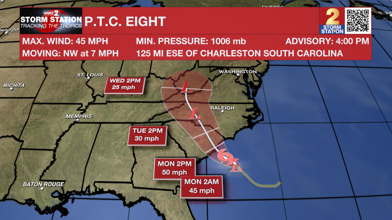
The Tropics: The National Hurricane Center began issuing advisories on Potential Tropical Cyclone Eight on Sunday afternoon. The "potential tropical cyclone" terminology is used when a disturbance does not meet the criteria to be a tropical depression or storm, but could do so and affect land within 48 hours. This allows the National Hurricane Center to begin issuing alerts and forecasts for the system well in advance of landfall. A Tropical Storm Warning has been issued along parts of the North and South Carolina coasts.
A tropical or subtropical storm could form in the next day or so before the center of the storm moves inland over the Carolinas. If that happens, the system would take the name Helene. Regardless of any tropical or subtropical development, gusty winds, heavy rain, flooding, storm surge, and tornadoes are likely across portions of the U.S. Southeast and Mid-Atlantic coast. Fortunately, this storm will not be an issue for Louisiana.
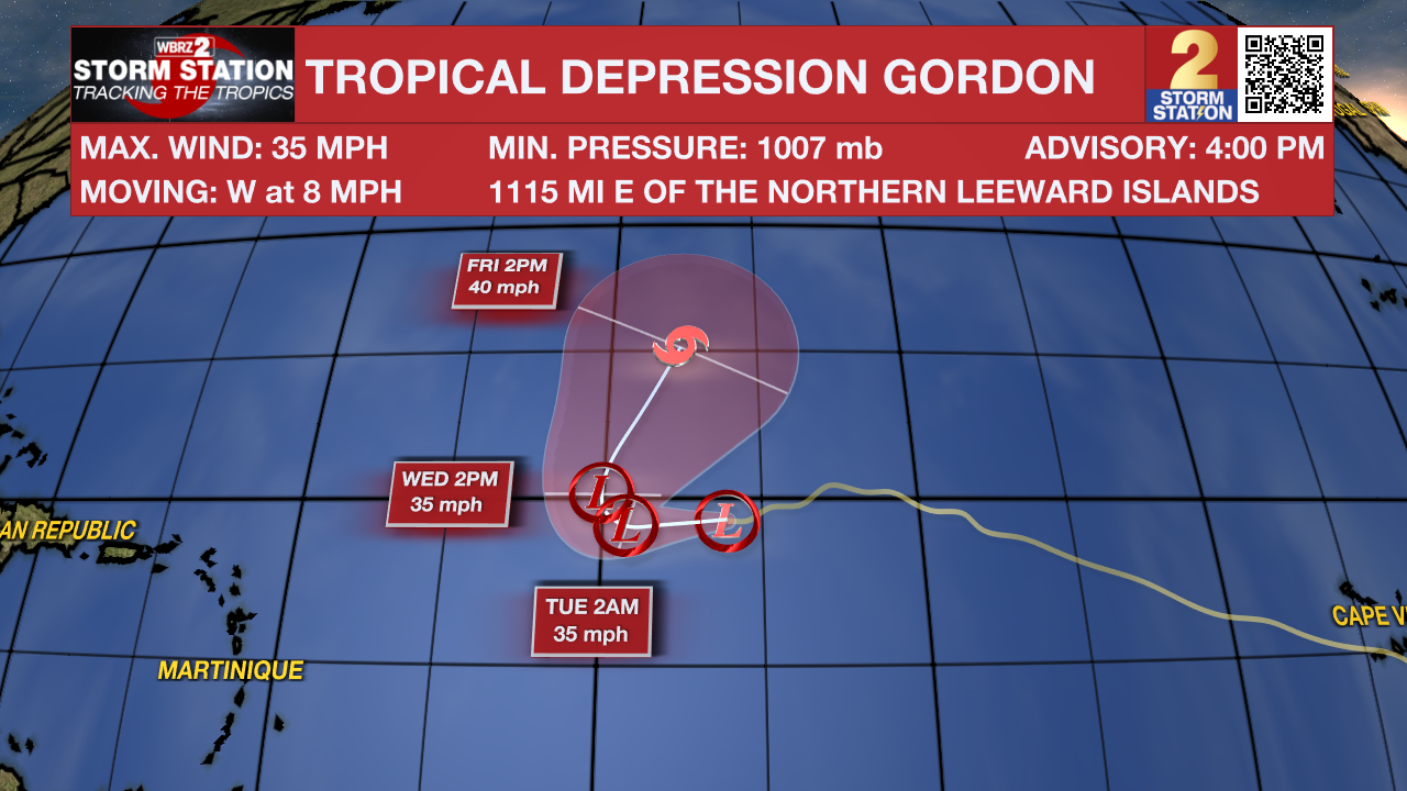
Gordon weakened into a Tropical Depression on Sunday. While the storm will remain weak, the latest forecast has the storm strengthening into a tropical storm by late week as it recurves out to sea. This storm will not pose a threat to land.
-- Meteorologist Malcolm Byron
The Storm Station is here for you, on every platform. Your weather updates can be found on News 2, wbrz.com, and the WBRZ WX App on your Apple or Android device. Follow WBRZ Weather on Facebook and Twitter for even more weather updates while you are on the go.
More News
