

Latest Weather Blog
Sunday PM Forecast: Even hotter days ahead, Debby becomes a hurricane
Heat continues to build for the upcoming week. With a push of "drier" air and overall lack of rain, the capital area could be looking at several days with highs at or above 100°.
Tonight & Tomorrow: Skies will be mostly clear on Sunday night with overnight lows remaining well above average. Look for an overnight low in the upper-70s to near 80° across the capital area. The morning begins with lots of sunshine, and the mostly sunny appearance will also prevail during the afternoon.
Debby (see The Tropics section below) will indirectly influence the local weather this week by pushing funneling drier air into the region. This will shut down rain chances, and might even lessen the humidity to an extent. However, temperatures will compensate. Look for a high temperature near 100° in Baton Rouge on Monday. Even with slight improvement in the mugginess, peak feels-like temperatures will still inch upward of 110°. For that reason, another Heat Advisory will be in place for just about everyone. The heat safety tips we've been practicing still apply - stay on top of your hydration and take breaks if outside for longer durations.
Up Next: Dry air continues to filter into the area through midweek, helping to extend the stay of 100°+ high temperatures. Similar to Monday, there may be a little improvement in humidity (especially the northern regions). That said, humidity levels will still be high enough to push peak feels-like temperatures near 110°. It will be hot for all the kids heading back to school. Heat also remains a common theme into the weekend, and rain will be a hard find. Fall can't get here soon enough.
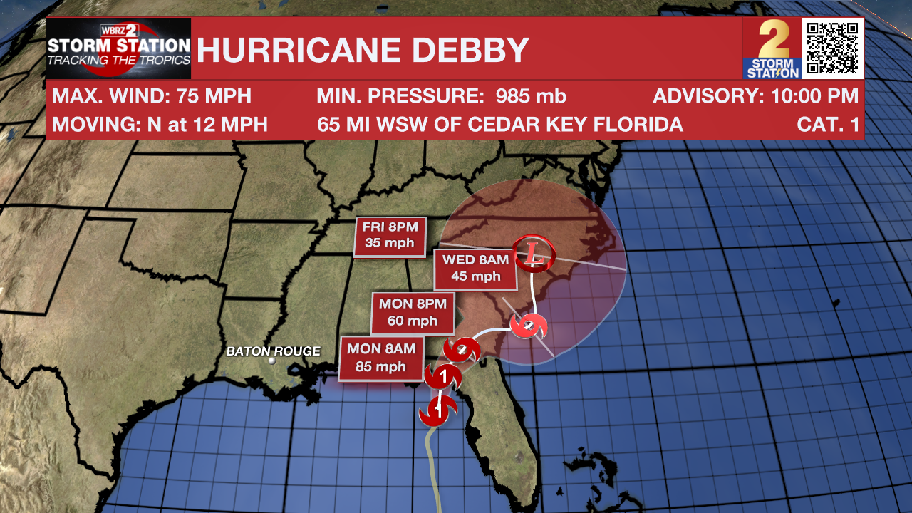
The Tropics: Debby became a hurricane on Sunday night as the storm takes aim at Florida. A landfall will occur in the Big Bend region of Florida early Monday. There, it will cause strong winds, life-threatening storm surge, and very heavy rain. Debby will then continue moving up the Southeast Coast. Unfortunately, its forward motion will slow by midweek. This will dump enormous amounts of rain across portions of the Carolinas, Georgia, and South Carolina where flooding is likely. This system will pose no direct impacts to Louisiana.
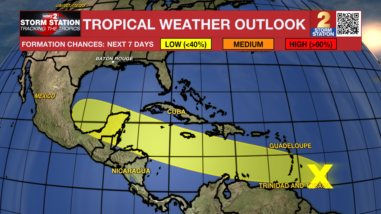
A tropical wave located a few hundred miles east of the Windward Islands continues to produce a disorganized region of thunderstorm activity. Conditions appear generally favorable for slow development over the next week as the system moves west at around 20 mph. The disturbance will cross the Windward Islands on Monday morning and then move into the central and western Caribbean by mid to late week.
Trending News
Get the latest 7-day forecast and real time weather updates HERE.
Watch live news HERE.
-- Meteorologist Malcolm Byron
The Storm Station is here for you, on every platform. Your weather updates can be found on News 2, wbrz.com, and the WBRZ WX App on your Apple or Android device. Follow WBRZ Weather on Facebook and Twitter for even more weather updates while you are on the go.
More News
