

Latest Weather Blog
Sunday PM Forecast: A hot and steamy Labor Day, several changes to follow
Although Labor Day is often coined the unofficial end of summer, it will feel awfully summer-like in the capital area. But the summer steam won't last forever. The Storm Station is tracking several changes in the next week, including another shot at heavy rain and a cold front.
Tonight & Tomorrow: Lingering showers should come to an end on Sunday evening, leaving behind mostly clear skies. Look for mostly sunny skies early Monday with a morning low in the mid-70s. Labor Day looks to be a hot one. High temperatures will rise into the middle-90s. Factor in the humidity and feels-like temperatures could climb as high as 108° by peak heating. For those with outdoor Labor Day plans, this would be a day to stay on top of hydration. A push of slightly drier air will make showers harder to find, but the area will not be rain-free. Expect spotty showers to fire during the afternoon, affecting roughly 20% of the Storm Station's 13 parish, 2 county coverage area surrounding Baton Rouge.
Up Next: A greater amount of moisture will attempt to trickle into the region on Tuesday. Clouds will increase as a result; however, this will only incur a minor uptick in rain coverage. Tuesday will still be warm with a high in the mid-90s. But by midweek, the Storm Station anticipates some big changes. An overabundance of tropical moisture returns on Wednesday and Thursday, producing numerous showers and thunderstorms each day. This will also help to hold back temperatures. There is a heavy rain risk with this round. Should too much rain fall in too little time, isolated pockets could end up dealing with some nuisance flooding.
The big changes don't stop at midweek. Friday will mark a transition from a soggy pattern to one that's just about bone dry. Confidence is growing that this change will be accompanied by a cold front. Should this front pass, it would result in lower humidity, cool mornings, and dry conditions for the weekend. This would be ideal for the LSU football home opener. Be advised that this is still many days away, and future adjustments might be needed. But it's a promising signal - stay tuned!
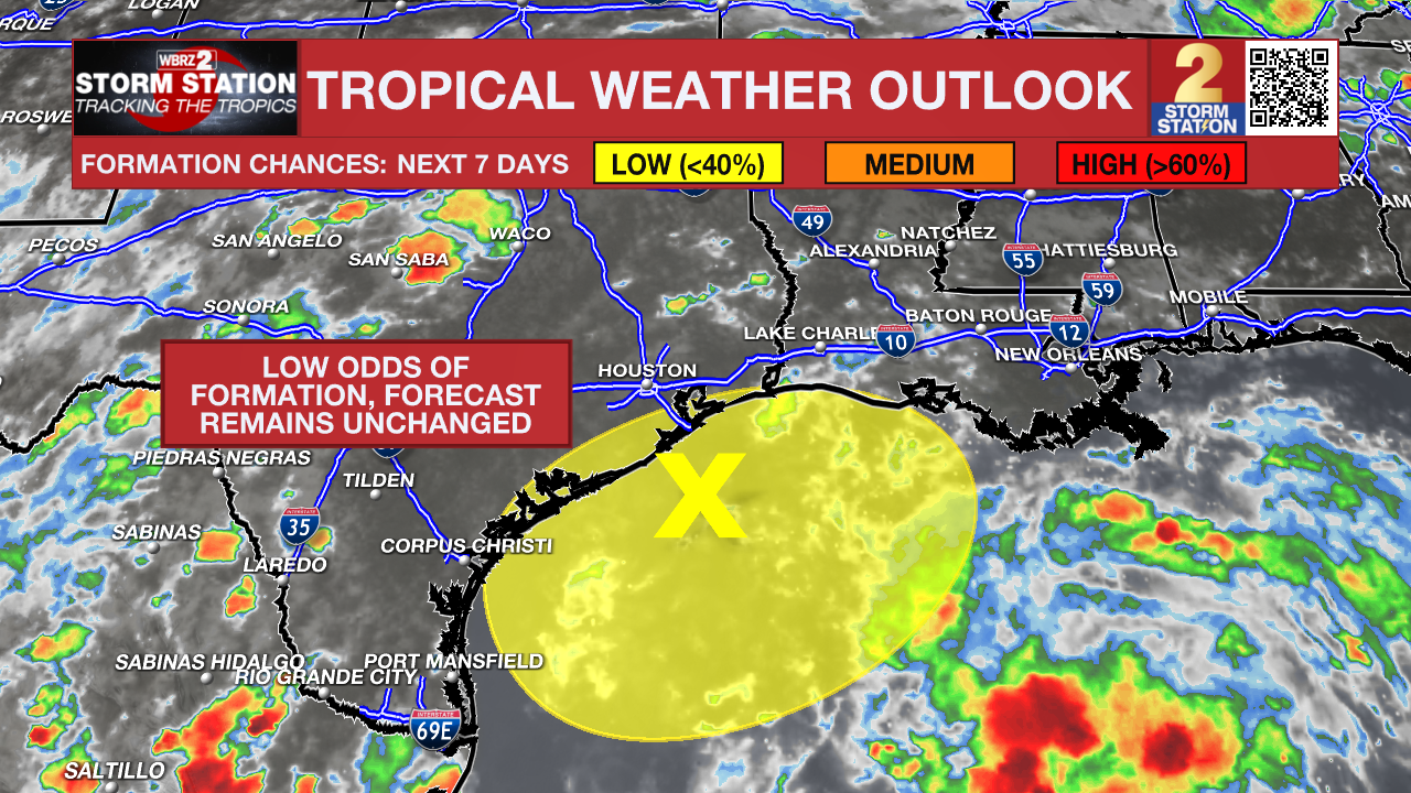
The Tropics: A disorganized area of low pressure just offshore the upper Texas coast continues to produce a few areas of storm activity near the TX/LA coasts. While this system is in close proximity to Louisiana, overall impacts will be low regardless of development. In other words, the Storm Station forecast (above) will not change even if the system becomes tropical in nature. This system will meander along the coast in the coming days. During this time, development odds appear low.
Another tropical wave located a few hundred miles east of the Lesser Antilles requires close monitoring. The disturbance remains disorganized, but will move westward into the Caribbean next week. Conditions will be more conducive for development during that time. A tropical depression could form closer to late week, but that is far from a guarantee. If it can happen, there is a change the storm moves into the Gulf of Mexico. However, it is still too far out to know anything about the long-term prospects of this system. Stay in touch with the Storm Station as new data continues to pour in.
Trending News
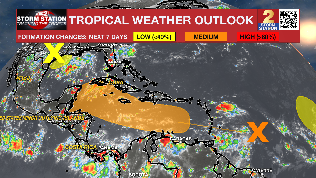
A third tropical wave located by the west Africa coast will move offshore by Monday. Slow development of this system is possible this week as it moves over the eastern tropical Atlantic. Fortunately, impacts to land appear low at this time.
Get the latest 7-day forecast and real time weather updates HERE.
Watch live news HERE.
-- Meteorologist Malcolm Byron
The Storm Station is here for you, on every platform. Your weather updates can be found on News 2, wbrz.com, and the WBRZ WX App on your Apple or Android device. Follow WBRZ Weather on Facebook and Twitter for even more weather updates while you are on the go.
More News
