

Latest Weather Blog
Sunday AM Forecast: warm temperatures, humidity, and a few showers the next several days
The weather around the capital area will stay non-impactful the next several days. It will be warm, but nowhere near the temperatures earlier in the summer. Also, rain coverage will stay pretty low.
Today & Tonight: Expect to be in and out of clouds for most of the day. This will create partly sunny skies. Highs will be near 90 degrees, with peak feels-like temperatures staying under 100. Overall, rain coverage looks unimpressive, and we should see less coverage than yesterday. This is mainly due to a little bit of drier air sneaking in. Just expect some spotty showers in the afternoon and evening. Some clouds will hang around in the overnight hours. Lows will be near 72 degrees.
Up Next: Early next week, lift and moisture will increase as the remnants of Francine slowly sag southward. Rain coverage looks to stay spotty to isolated in nature on Monday and Tuesday. By Wednesday, an upper level ridge will build across the southern United States. This feature will bring an end to the small rain chances. All week long, it will be warm, with high temperatures in the upper 80's, and lower 90's. It will also remain a touch humid.
Get the latest 7-day forecast and real time weather updates HERE.
Watch live news HERE.
Trending News
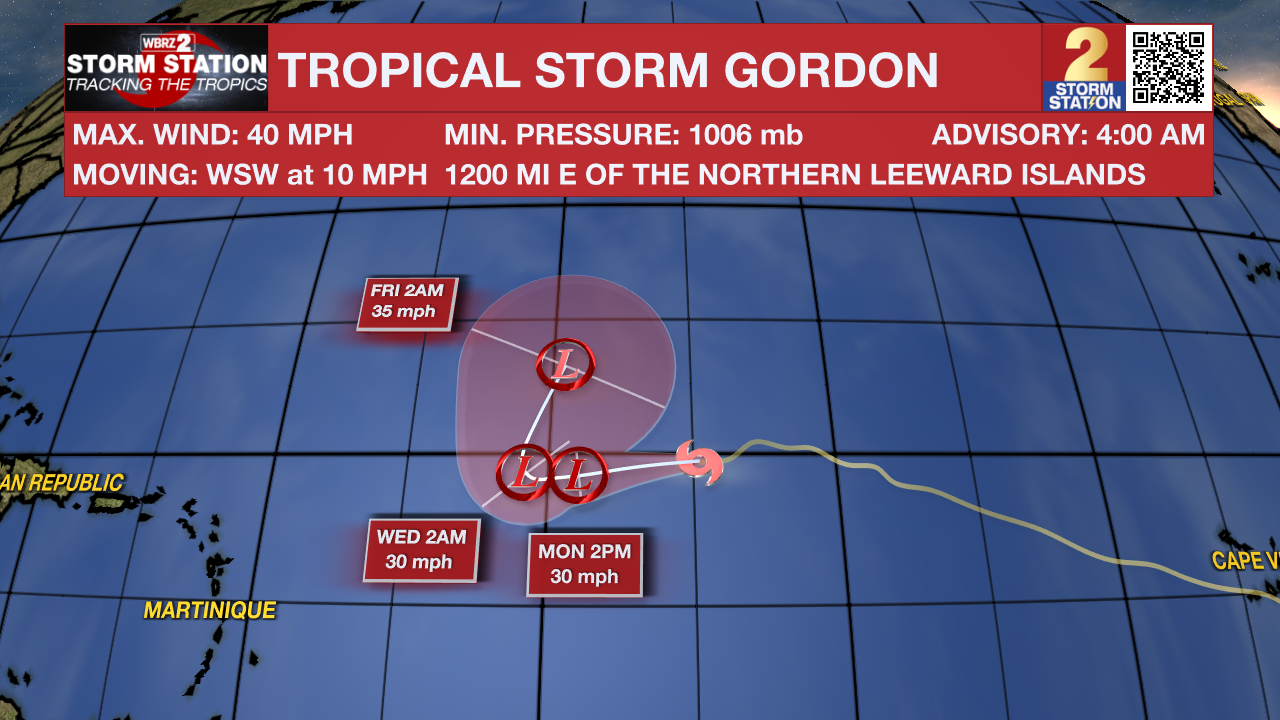
The Tropics: Tropical Storm Gordon is barley hanging on, with maximum sustained winds of 40mph. It is moving WSW at 10 mph. This storm will weaken to a depression sometime today and remain over open water.
A non-tropical low pressure area is located along a frontal boundary a couple of hundred miles off the southeastern U.S. coast, and is producing winds to gale force north of its center. The low is forecast to move northwestward or northward over the warm waters of the Gulf Stream toward the coasts of North Carolina and South Carolina, and it could become a subtropical or tropical storm during the next day or two if the associated front dissipates and showers and thunderstorms become sufficiently organized.
– Balin
The Storm Station is here for you, on every platform. Your weather updates can be found on News 2, wbrz.com, and the WBRZ WX App on your Apple or Android device. Follow WBRZ Weather on Facebook and Twitter for even more weather updates while you are on the go.
More News
