

Latest Weather Blog
Sunday AM Forecast: rain coverage scaling back the next few days
After a soggy Saturday, rain coverage will creep down the next few days. Scattered activity is expected Sunday, and only isolated activity is expected for Labor Day.
Today & Tonight: Moisture content has decreased somewhat across the area. This will translate to not as many showers on radar. About 60% of the viewing area will pick up measurable rainfall through the afternoon. The greatest chance of rain will be near the coast, with chances decreasing the further north you get. Highs will get to near 90 degrees under mostly cloudy skies. Tonight, expected partly cloudy skies, with lows in the middle 70's.
Up Next: Rain coverage will move down even further for Labor Day. Only isolated pop-up storms are expected. Because of the lack of rain, and less cloud cover, highs will make it to the lower 90's. The break in higher rain coverage will be short lived. A front will approach the area on Tuesday, but likely stall before it gets here. High moisture content will pool ahead of this front. This will lead to multiple days of showers and storms being likely. There are some indications that this front will be pushed southward late week, and even move through the area. This would lower rain chances, decrease humidity, and slightly lower temperatures for next weekend. Confidence for this front making it through is on the lower side at the moment, and further adjustments will likely have to be made.
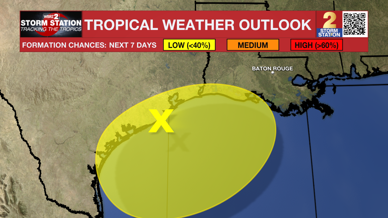
The Tropics: Three areas are currently being watched in the tropics. The first one, is pretty close to home.
Trending News
A broad area of low pressure near the upper Texas coast continues to produce some shower and thunderstorm activity along and just offshore of the coasts of Texas and Louisiana. This system is expected to linger near the coast for the next several days, and some slow development is possible if it remains offshore. Regardless of development, heavy rains could cause some flash flooding across portions of coastal Louisiana and the upper Texas coast during the next few days.
The next two areas are in the tropical Atlantic.
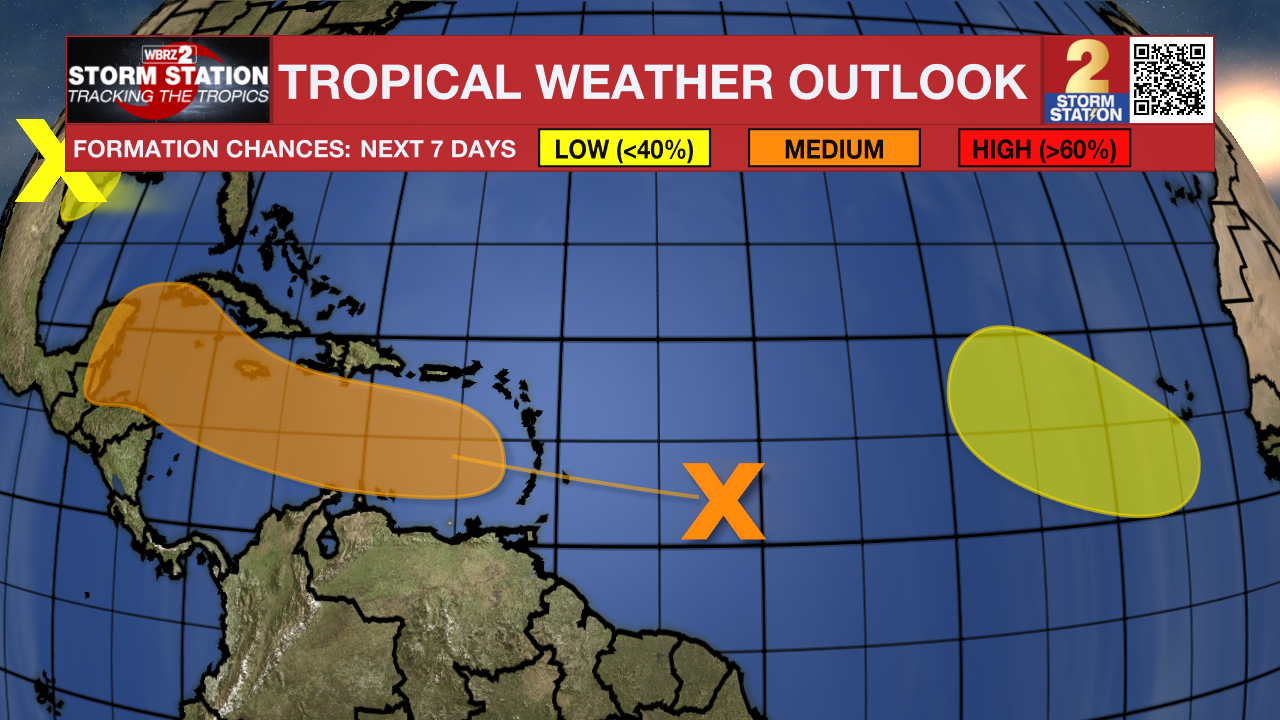
Shower activity associated with a tropical wave located several hundred miles east of the Lesser Antilles has changed little in organization since yesterday. Some slow development is possible as the disturbance moves westward and reaches the Lesser Antilles on Monday. The wave is expected to move across the central and western Caribbean Sea later this week, where conditions are forecast to become more conducive for some development, and a tropical depression could form during that time.
A tropical wave over western Africa is forecast to move offshore on Monday. Thereafter, environmental conditions could support some slow development throughout the week while the system moves slowly westward or west-northwestward over the eastern tropical Atlantic Ocean.
Get the latest 7-day forecast and real time weather updates HERE.
Watch live news HERE.
– Balin
The Storm Station is here for you, on every platform. Your weather updates can be found on News 2, wbrz.com, and the WBRZ WX App on your Apple or Android device. Follow WBRZ Weather on Facebook and Twitter for even more weather updates while you are on the go.
More News
