

Latest Weather Blog
Saturday PM Forecast: staying unseasonably warm this weekend, change is on the way
Warm temperatures and humidity will continue all weekend long. There is light at the end of the tunnel, as a significant front will pass Monday, bringing much cooler and drier conditions.
Today & Tonight: Most have started off this morning with a decent amount of cloud cover. These clouds will stick around for most of the day. Some peaks of sunshine will still be possible. Even though there will be a lot of clouds, rain looks to be pretty unlikely. Some spotty showers will be possible but most will stay dry. Temperatures will be unseasonably warm, with highs in the upper 80's. Clouds will start to thin as we head into the overnight hours. Lows will be in the lower 70's.
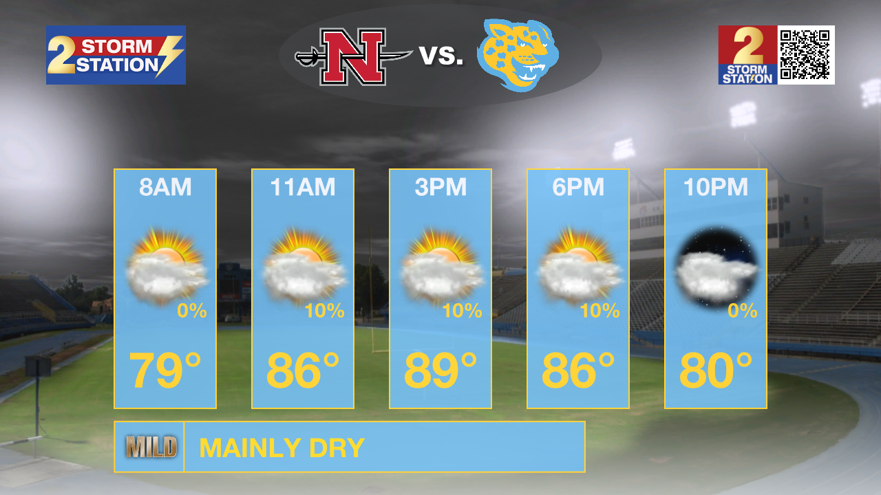
Up Next: Moisture values will decrease even further Sunday, leading to more sunshine, and low rain coverage. On Monday, moisture will diminish as we await the arrival of a cold front. This front will push through during the evening hours followed by the coolest and driest air so far this season. All week long, highs will be in the middle 80's, with lows near 60 degrees. Some locations, especially north of Baton Rouge, could dip into the upper 50's some nights. The pleasant weather will likely have some staying power through the end of the workweek and likely even into next weekend.
Trending News
Get the latest 7-day forecast and real time weather updates HERE.
Watch live news HERE.
The Tropics: Major Hurricane Kirk remains a powerful storm with maximum sustained winds of 125mph. Though large swells from this system could reach the United States by Sunday, Kirk is a fish storm with a northwest motion becoming north and then northeast by next week as the storm loses strength and heads for Europe.

Following Kirk is Hurricane Leslie which is also gradually getting better organized. Maximum sustained winds are now 80mph as the storm moves west and then northwest this weekend following Kirk out to sea.
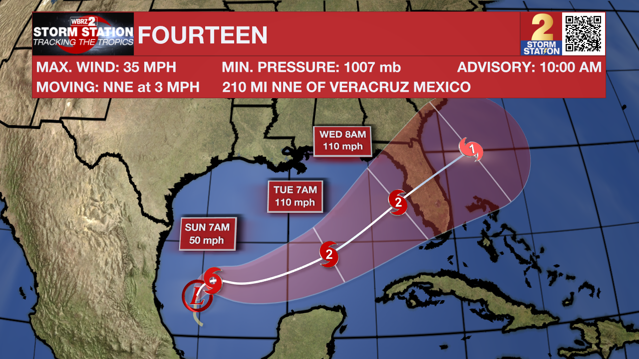
Tropical Depression Fourteen has formed in the southwestern Gulf of Mexico. Thankfully, Louisiana impacts looks very low. Some higher swells and coastal flooding is possible. Future Milton will approach Florida early Wednesday as a strong cat 2 hurricane. A major hurricane cannot be ruled out.
A tropical wave is expected to move off the west coast of Africa on Monday or Tuesday. Some development of this system is possible thereafter while it moves westward or west-northwestward across the eastern tropical Atlantic. The system is expected to move near or
over the Cabo Verde Islands on Wednesday and Thursday, and interests there should monitor its progress.
– Balin
The Storm Station is here for you, on every platform. Your weather updates can be found on News 2, wbrz.com, and the WBRZ WX App on your Apple or Android device. Follow WBRZ Weather on Facebook and Twitter for even more weather updates while you are on the go.
More News
