

Latest Weather Blog
Saturday PM Forecast: more showers Sunday, drier air moves in for Labor Day
Many will be dodging showers once again on Sunday, although coverage will scale back a bit. Drier air will move in for Labor Day, leading to only isolated pop-up storms.
Tonight & Tomorrow: Tonight, most remaining showers will fizzle out. A few passing showers throughout the night are possible. Lows will be in the middle 70's under mostly cloudy skies. While slightly lower than Saturday, moisture content will stay high on Sunday. Shower activity will begin to increase in the morning, with hit and miss showers through the afternoon. About 60% of the viewing area will pick up measurable rainfall. Drier air will move in by the evening, so we should start to clear out at that time. Highs will be in the upper 80's under mostly cloudy skies.
Up Next: Labor day will be a lot drier than it was over the weekend. Only isolated pop-up storms are expected. Because of the lack of rain, and less cloud cover, highs will make it to the lower 90's. The break in higher rain coverage will be short lived. Moisture will increase once again on Tuesday, and stay high through most of the week. This will increase the chances of rain. Although far out, there are some early indications that a front will approach the area late week and into the weekend. Whether or not it makes it here is a bit up in the air right now. Hopefully it does, because this will eliminate rain chances for next weekend, lead to below average temperatures, and lower humidity.
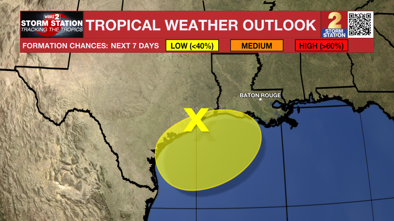
The Tropics: Three areas are currently being watched in the tropics. The first one, is pretty close to home.
Trending News
A broad area of low pressure near the upper Texas coast is producing some disorganized showers and thunderstorms along and just offshore the coasts of Texas and Louisiana. This system is expected to linger near the coast through much of next week, and some slow development is possible if it meanders offshore. Regardless of development, heavy rains could cause some flash flooding across portions of coastal Louisiana and the upper Texas coast during the next few days.
The next two areas are in the tropical Atlantic.
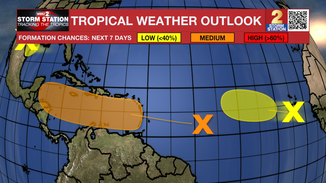
A tropical wave located several hundred miles east of the Lesser Antilles continues to produce some disorganized showers and thunderstorms. The disturbance is forecast to move westward and reach the Lesser Antilles on Monday. Thereafter, environmental conditions appear conducive for gradual development of this system, and a tropical depression could form while it continues moving westward across the Caribbean Sea through the middle to latter part of the week.
Another tropical wave located just to the west of the Cabo Verde Islands is producing disorganized shower and thunderstorm activity. Development, if any, should be slow to occur while the system moves slowly westward to west-northwestward over the eastern and central tropical Atlantic through late next week.
Get the latest 7-day forecast and real time weather updates HERE.
Watch live news HERE.
– Balin
The Storm Station is here for you, on every platform. Your weather updates can be found on News 2, wbrz.com, and the WBRZ WX App on your Apple or Android device. Follow WBRZ Weather on Facebook and Twitter for even more weather updates while you are on the go.
More News
