

Latest Weather Blog
Saturday AM Forecast: Slow moving front brings drier air and clearing skies this weekend
A slow moving front will gradually swipe away clouds and deliver drier air to the Capital Area over the next 24 hours. Breezy conditions will accompany the fronts arrival with very comfortable weather in place for the second half of the weekend.
Today & Tonight: Clouds will remain in place until the slow moving front, located across northern Louisiana early Saturday, moves further south during the day. Conditions will be cool, in the 70's, during morning hours with a northerly breeze between 10-20 mph persisting all day. One or two spotty showers cannot be ruled out in southeast Louisiana on Saturday, though most will remain dry. Sun will begin to break through the clouds by mid-day, with a mix of sun and clouds forecast all afternoon. For those heading out to tailgate or to cheer on the LSU Tigers or Southern Jags today, expect temperatures this afternoon in the low to middle 80's. Once the sun sets around 7:20 pm Saturday evening, temperatures will begin to fall into the middle and lower 70's likely before the games are complete.
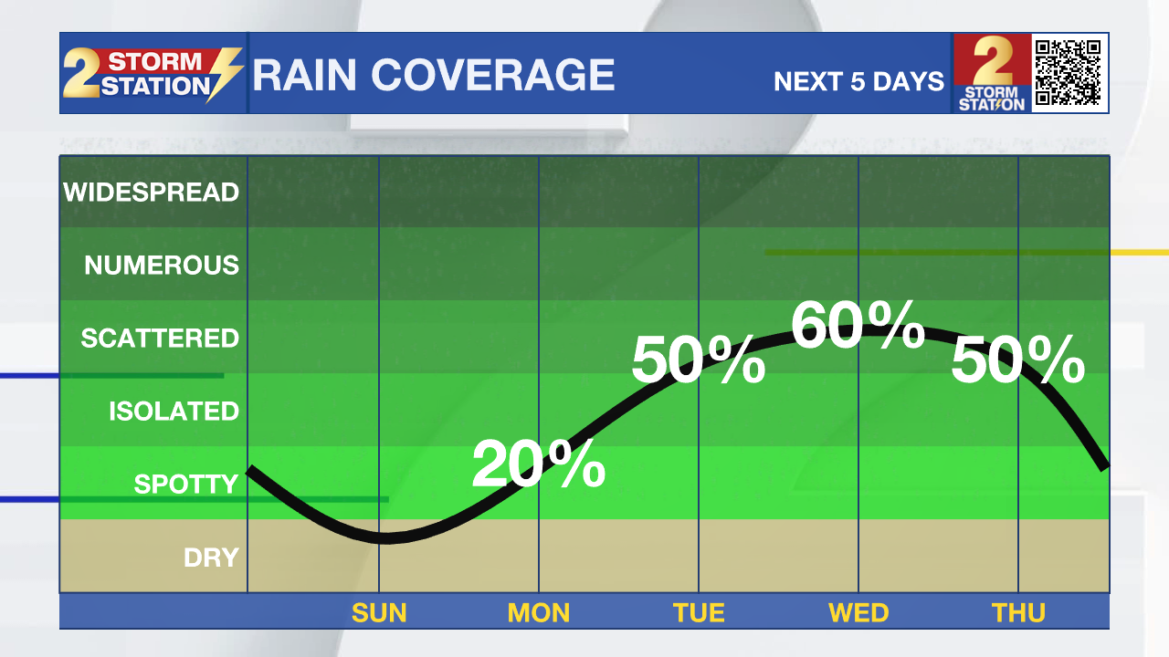
Up Next: A reinforcing shot of dry air on Sunday morning is likely to bring a much more comfortable air mass. Morning lows Sunday and Monday will dip below average for early September, into the mid 60s. Afternoons highs will also be comfortable in the upper 80s with low humidity. Rain will make a prompt return by Tuesday and into the middle of next week as another bountiful amount of gulf moisture is set to arrive to the area.
Get the latest 7-day forecast and real time weather updates HERE.
Trending News
Watch live news HERE.
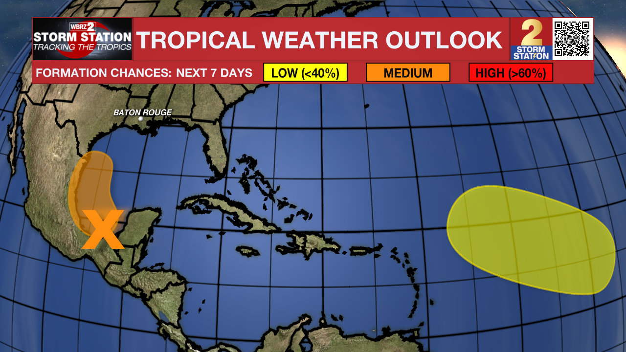
The Tropics: A tropical wave located over Belize and the Yucatan Peninsula of Mexico is producing disorganized showers and thunderstorms. The wave is forecast to move into the Bay of Campeche today, where it could then begin to interact with a frontal boundary. A tropical depression could form during the early or middle part of next week while the system moves slowly northwestward over the southwestern Gulf of Mexico. This system is not expected to bring direct impacts to southern Louisiana but will likely help motivate more heavy rains across the northern gulf coast next week.
An elongated trough of low pressure over the eastern tropical Atlantic is producing minimal shower and thunderstorm activity. Development, if any, should be slow to occur while the disturbance meanders through the early part of next week and then begins to move west-northwestward across the central tropical Atlantic during the middle to latter part of next week.
- Emma Kate C.
The Storm Station is here for you, on every platform. Your weather updates can be found on News 2, wbrz.com, and the WBRZ WX App on your Apple or Android device. Follow WBRZ Weather on Facebook and Twitter for even more weather updates while you are on the go
More News
