

Latest Weather Blog
Saturday AM Forecast: great weather for outdoor activities this weekend
We are entering a much needed quiet stretch of weather in the capital area. For the next 7 days, it will be warm, with rain coverage staying pretty minimal.
Today & Tonight: Any dense fog we had this morning will quickly dissipate by 10-11am. After that, there will be a lot of sunshine. Highs will get into the lower 90's under partly sunny skies. A few spotty showers will be possible in the afternoon and evening, but most will stay dry. A few clouds will stick around in the overnight hours. Lows will be near 70 degrees,
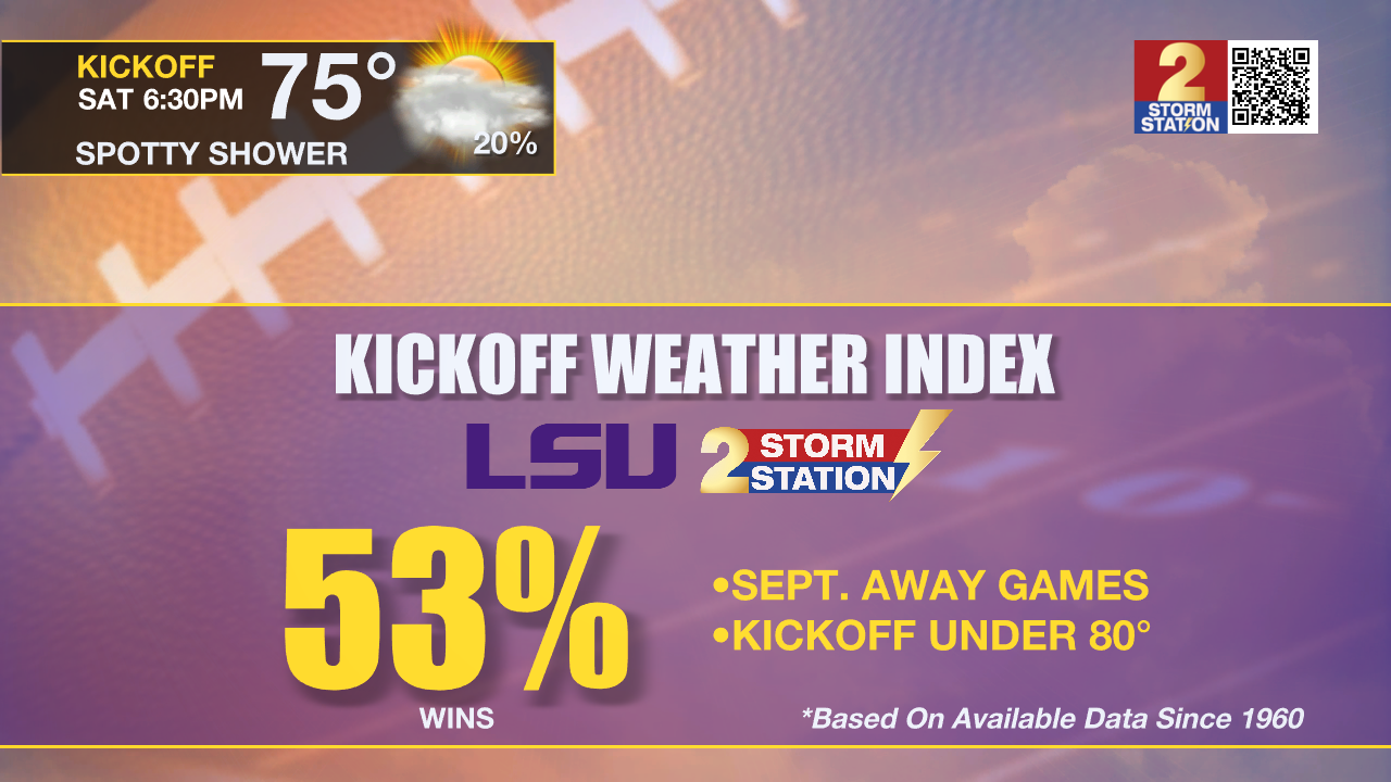
Football Forecasts: Both Southern and LSU take to the road on Saturday. In Jackson, Southern can expect to kickoff to a temperatures in the upper 70s with only a stray shower possible. Over in Columbia, LSU will also find game time temperatures in the 70s. Since 1960, LSU has won 53% of road games in September with a temperature under 80 degrees. The last loss in those conditions was against Wisconsin in 2016. There is a much lower chance for rain than earlier in the week. Should there be showers, the historical win percentage drops just below 50%.
Up Next: Expect similar weather tomorrow. It will be warm, with a few spotty showers. By early next week, the remnants of Francine will slowly sag southward. This will cause lift and moisture to slightly increase. The best, but still small chance of rain, will be on Monday and Tuesday. There will not be any major change in temperatures through early next week. By Wednesday, an upper level ridge will start to take foot across the southern United States. This feature will bring an end to the small rain chances and keep temperatures above average with highs in the low 90s and lows in the low 70s. It will also remain a touch humid.
Trending News
Get the latest 7-day forecast and real time weather updates HERE.
Watch live news HERE.
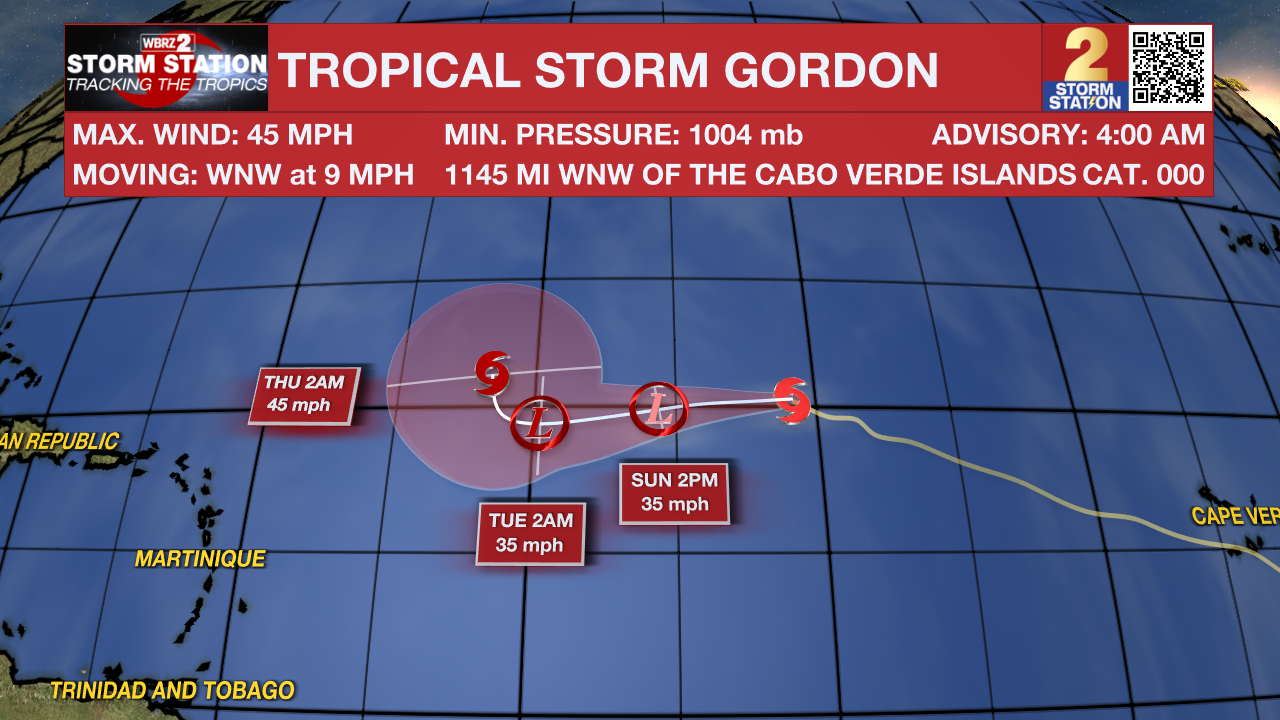
The Tropics: Tropical Storm Gordon has maximum sustained winds of 45mph, and is looking poorly organized. It is moving WNW at 9 mph. This storm will remain over open water.
A non-tropical area of low pressure is expected to form this weekend along a frontal boundary a few hundred miles off the southeastern U.S. coastline. The system could gradually acquire subtropical or tropical characteristics thereafter over the warm waters of the Gulf Stream, and a subtropical or tropical depression or storm could form early next week while the system moves generally northwestward toward the coast.
– Balin
The Storm Station is here for you, on every platform. Your weather updates can be found on News 2, wbrz.com, and the WBRZ WX App on your Apple or Android device. Follow WBRZ Weather on Facebook and Twitter for even more weather updates while you are on the go.
More News
