No washouts expected but umbrellas will be needed
While no washouts are expected in the days ahead, a few bouts of showers and thunderstorms could inconvenience some after school activities and drive times. Thermometers will start to climb above average.
THE FORECAST:

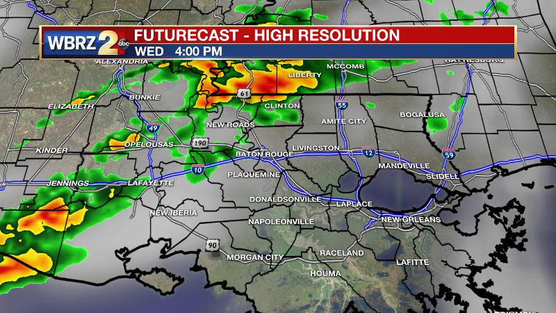
Today and Tonight: Wednesday will begin a gloomier pattern in the Capital City and surrounding area. Mostly cloudy skies are expected as high temperatures climb into the upper 70s. Scattered showers will develop mainly north and west of Baton Rouge. Thunder and lightning will be sparse. South of I-10 and closer to New Orleans, it is possible that many locations will remain dry. All in all, expect about 40 percent of the 13 Parish, 3 County forecast area to pick up measurable rain. Clouds and spotty showers remain in play overnight with lows in the upper 60s making it feel muggy.
Trending News

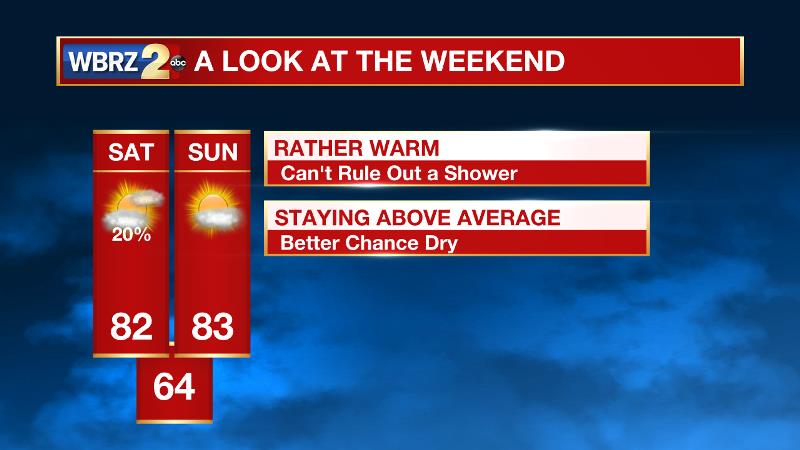
Up Next: Off and on bouts of showers and thunderstorms are anticipated through the end of the week. It will not rain constantly, and while measurable rain is expected everywhere by Friday, amounts will be light over the three day stretch with up to an inch possible. In addition to the unsettled weather, thermometers will make a push back toward and eventually above average. The forecast is trending drier for the weekend. Highs will be in the low 80 with lows in the low to mid 60s through Sunday.
The Tropics: Today marks the final official month of hurricane season. The Atlantic Basin, including the Gulf of Mexico, is quiet.
THE EXPLANATION:
A weak stationary front will stall across the area on Wednesday. This feature will draw Gulf moisture northward and allow for some showers and thunderstorms to develop, primarily focusing near the available frontal lift north and west of Baton Rouge. Meantime, a broad upper level trough will begin to erode through Thursday and as a result, so too will the stalled front. As a ridge begins to build in the southern Gulf of Mexico, some lobes of energy riding around the northern periphery of this ridge may be able to trigger the development of some showers and thunderstorms across the central Gulf Coast. The most vigorous of these lobes appears to come on Friday afternoon/evening with an embedded shortwave in the jet stream to our north. The only question is if whether or not enough moisture will be available. Given the limited moisture fields shown by forecast models, expect coverage to remain low. Over the weekend, the ridge will build north, effectively ending precipitation development and warming high and low temperatures a good 5 to 10 degrees above average. Mild and benign conditions are anticipated early next week before the next storm system returns a chance for showers and thunderstorms by Wednesday or so.
--Josh
The WBRZ Weather Team is here for you, on every platform. Your weather updates can be found on News 2, wbrz.com, and the WBRZ WX App. on Apple and Android devices. Follow WBRZ Weather on Facebook and Twitter for even more weather updates while you are on the go.


