

Latest Weather Blog
Nice end to the weekend, eyeing another severe risk next week
TONIGHT & TOMORROW
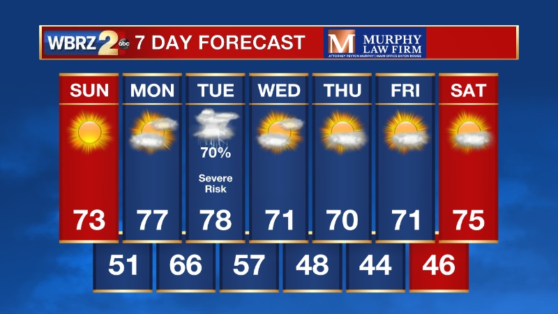
Tonight will be chilly with temperatures dropping into the low 40s, so prepare to grab some layers out the door Sunday morning. Sunny skies will warm us up Sunday afternoon with highs in the upper 70s. Southerly winds are back Sunday night bringing in warmer Gulf air.
LOOKING AHEAD
We will start the new week off dry on Monday, before our next storm system rolls in on Tuesday. This system will have the potential to bring an outbreak of severe weather from Texas to Mississippi late Monday, into Tuesday.
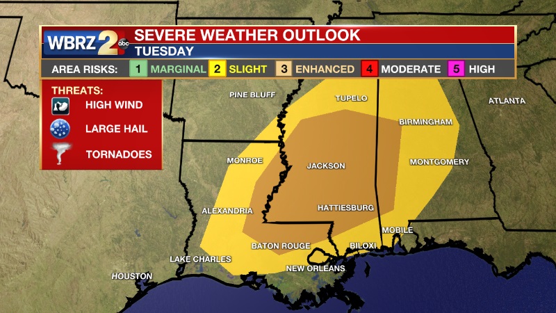
Right now, the Baton Rouge metro is under a Level 3 (Enhanced Risk) for severe weather on Tuesday. Storms that develop Tuesday afternoon and evening will have the potential to be strong to severe and also produce heavy rainfall. Stay tuned to the WBRZ Weather Team for more details in the coming days.
Trending News
-- Meteorologist Jake Dalton
Your weather updates can be found on News 2, wbrz.com, and the WBRZ WX App on your Apple or Android device. Follow WBRZ Weather on Facebook and Twitter for even more weather updates while you are on the go.
More News
