

Latest Weather Blog
Monday PM Forecast: widespread rain before big drop in humidity
There is a lot to follow in the Storm Station 7-Day Forecast with multiple impacts ahead. First, the middle part of the workweek will be quite wet with rounds of showers and thunderstorms. Second, the first fall front of the season is slated to move through early in the weekend.
Tonight & Tomorrow: A rogue shower will remain possible through midnight. Largely quiet conditions are expected overnight though with just a few clouds. The muggy feel will persist with lows in the mid 70s. Tuesday will not be dissimilar to Monday. A lot of sunshine early will drive high temperatures into the upper 90s. Enough humidity will be around for feels-like temperatures to maximize between 103 – 108 degrees. Cumulus clouds will build through the afternoon and one or two could grow tall enough to squeeze out a spotty shower or thunderstorm.
Up Next: Wednesday through Friday, an upper level trough of low pressure will create more instability (energy for rain, thunderstorms) across the central Gulf Coast. At the same time, total moisture in the atmosphere will climb to well above average level. The combination of these two features will result in numerous to widespread showers and thunderstorms each day. The ripe storm environment will also return the possibility of a low end flood risk to where some street and poor drainage issues could occur. By late Friday, a front will start to push through from north to south, swiping the thick moisture away from the region. This will be felt in the form of much lower humidity and noticed by skies clearing into the weekend. A reinforcing shot of dry air on Saturday is likely to bring the driest and coolest air felt since early June. We might be able to classify that incoming air mass as the first taste of fall this season.
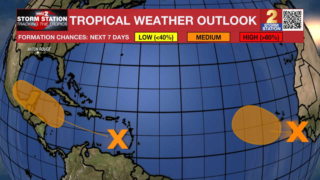
The Tropics: A tropical wave is producing disorganized thunderstorms and gusty winds across portions of the Lesser Antilles, Puerto Rico, Hispaniola and over the adjacent waters. Environmental conditions are forecast to become more conducive for development when the system reaches the western Caribbean Sea and southwestern Gulf of Mexico late this week and over the weekend, and a tropical depression could form during that time.
Trending News
Another tropical wave over the far eastern Atlantic is producing disorganized showers and thunderstorms. Environmental conditions are forecast to become a little more conducive for development, and a tropical depression could form in a few days while the disturbance moves slowly west-northwestward or northwestward over the eastern tropical Atlantic Ocean. This system could produce areas of heavy rain and gusty winds across portions of the Cabo Verde Islands in a day or two.
Get the latest 7-day forecast and real time weather updates HERE.
Watch live news HERE.
– Josh
The Storm Station is here for you, on every platform. Your weather updates can be found on News 2, wbrz.com, and the WBRZ WX App on your Apple or Android device. Follow WBRZ Weather on Facebook and Twitter for even more weather updates while you are on the go.
More News
