

Latest Weather Blog
Monday PM Forecast: tropical showers from remnants of Beryl into Tuesday
A band of showers associated with the remnants of Hurricane Beryl is expected to pass through the Capital Area overnight and into Tuesday. Wednesday and beyond, a typical summer weather pattern is in store.
Tonight & Tomorrow: A very tropical air mass is in place and that has been felt of late. The humidity will make it difficult for overnight temperatures to fall much beyond the low 80s. Additionally, that tropical moisture will help fuel a frontal feature associated with the remnants of Beryl. Numerous showers and thunderstorms are expected after midnight and through daybreak on Tuesday. Since they will be tropical in nature, any showers and thunderstorms could dump a lot of rain in a short time and so some localized street and poor drainage flooding is possible. An isolated tornado cannot be ruled out either, also common with landfalling tropical systems. Tropical showers and thunderstorms will advance from west to east through the morning before laying near the coast by afternoon. With some returning sunshine, afternoon temperatures will return to the low 90s. Expect a southwest breeze of 10-15mph through the day.
Up Next: In the wake of Beryl, a slightly drier air mass will push toward the central Gulf Coast for Wednesday and Thursday. This drier air mass will present a forecast challenge with regard to rain coverage. If it can infiltrate as far south as about I-10/12, which is possible, rain coverage will be reduced for points to the north. However, scattered showers and thunderstorms will still be possible near the coast. Where the drier resides, you might notice low temperatures about 5 degrees cooler Wednesday and Thursday with readings in the mid 70s. Heat will persist in the afternoons with high temperatures in the mid 90s. Over the weekend, heat will become the dominant story once again with highs in the upper 90s, lows in the upper 70s and only spotty to isolated afternoon showers and thunderstorms.
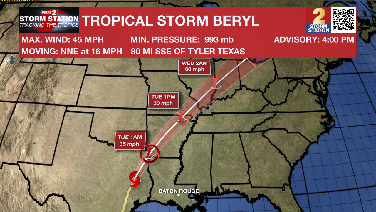
The Tropics: Hurricane Beryl made landfall near Matagorda, Texas shortly before 4 a.m. Monday. At landfall, the hurricane was at Category 1 strength with peak winds at 80 mph. As of 4pm Monday, Beryl continued weakening over northeast Texas. Maximum sustained winds of 45mph will continue to decrease as the storm moves northeast at 15-20mph. The system will continue to bring gusty winds, heavy rain and severe weather across parts of Texas, Arkansas and northern Louisiana as it degenerates into a remnant low by Tuesday.
Trending News
Get the latest 7-day forecast and real time weather updates HERE.
Watch live news HERE.
– Josh
The Storm Station is here for you, on every platform. Your weather updates can be found on News 2, wbrz.com, and the WBRZ WX App on your Apple or Android device. Follow WBRZ Weather on Facebook and Twitter for even more weather updates while you are on the go.
More News
