

Latest Weather Blog
Monday PM Forecast: Streak of triple-digit heat this week
Triple-digit heat is a common theme this week in the Storm Station forecast. Even with a slight dip in humidity, enough will stick around to result in more afternoons with dangerous feels-like temperatures.
Tonight & Tomorrow: Monday night won't be much of a change from recent nights. Skies will be mostly clear with a very warm overnight low - near 79° in Baton Rouge. The capital area will see another very hot day on Tuesday with highs eclipsing the 100° mark. A push of dry air will shut down rain chances and push the humidity down to slightly lower levels. That said, there will still be humidity to feel, and it will place peak feels-like temperatures upward of 112°. A Heat Advisory continues into Tuesday for this reason, so continue practicing the same heat safety that the Storm Station has been preaching for the last few weeks.
Up Next: The rest of the week features a continuation of the hot and dry pattern. Afternoon highs appear to reach or surpass the century mark at least through late week, resulting in a streak of days with triple-digit heat. Again, while the humidity might be a touch lower, it will still be high enough to produce dangerous feels-like temperatures during the heat of the day. More heat alerts are likely for the remainder of the workweek. Especially with kids heading back to school, hydration will be key for any outdoor after-school activities. Rain is scarce on the Storm Station 7-Day Forecast. Most will not pick up any meaningful rainfall in the next week.
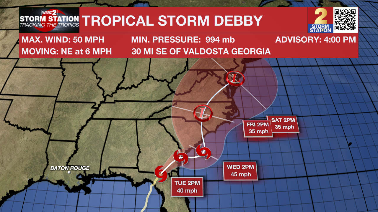
The Tropics: After making landfall in the Big Bend region of Florida early Monday, Debby pushed inland through the morning, weakening to a tropical storm during that time. Debby will continue northeast through Georgia and the Carolinas in the coming days. As this happens, the storm's forward motion will slow to a crawl. This will produce major flooding over parts of Georgia and the Carolinas. Debby will not bring any direct impacts to Louisiana.
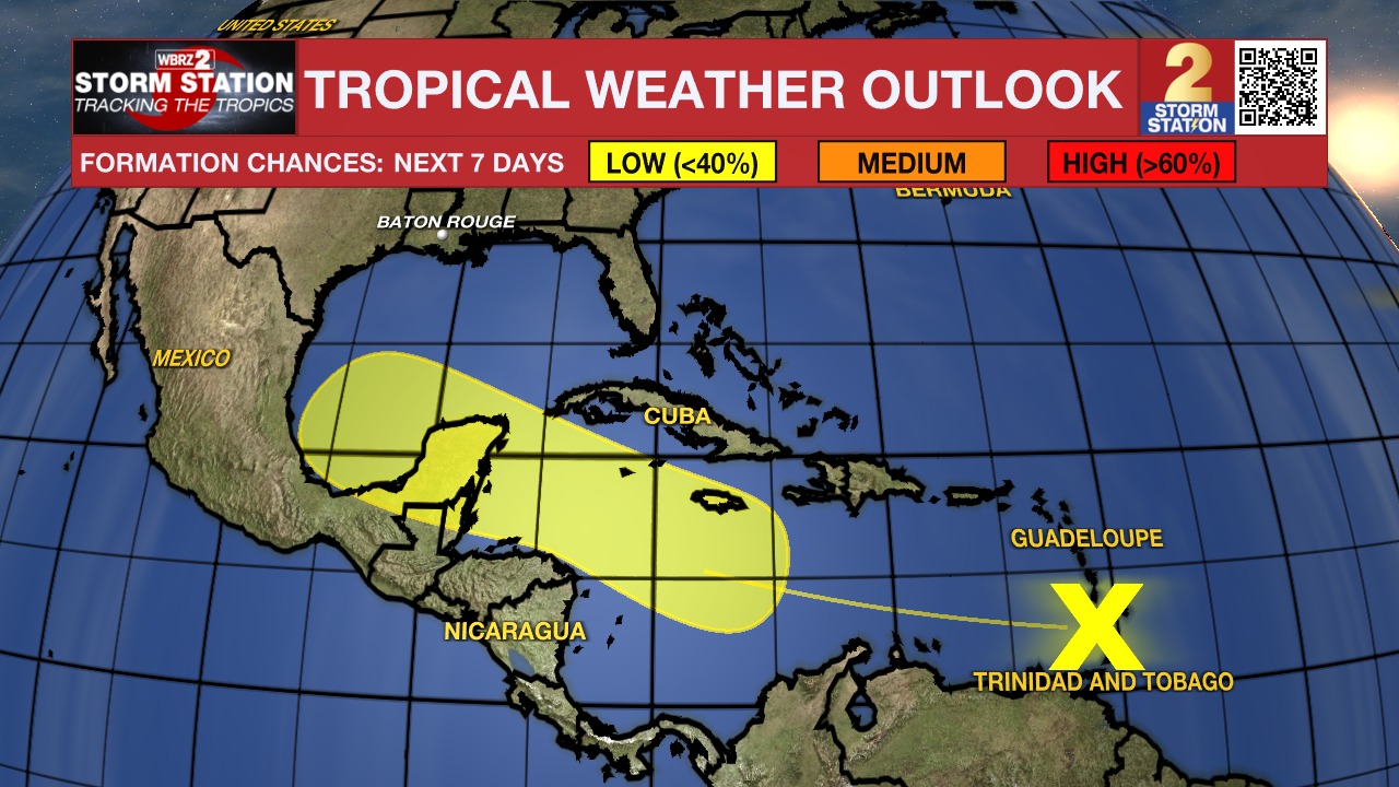
A tropical wave located near the Windward Islands continues to produce a disorganized region of thunderstorm activity. For the time being, additional development would be slow to occur. However, conditions appear generally favorable for future development as the system moves westward into the western Caribbean Sea and southern Gulf of Mexico.
Trending News
Get the latest 7-day forecast and real time weather updates HERE.
Watch live news HERE.
-- Meteorologist Malcolm Byron
The Storm Station is here for you, on every platform. Your weather updates can be found on News 2, wbrz.com, and the WBRZ WX App on your Apple or Android device. Follow WBRZ Weather on Facebook and Twitter for even more weather updates while you are on the go.
More News
