

Latest Weather Blog
Monday PM Forecast: racking up more 90s for last week of summer
Overall, a quiet week of weather is ahead. If you are going to pick up some rain, Tuesday is the best bet.
Tonight & Tomorrow: Partly cloudy skies will carry well not the night. A spotty shower cannot be ruled out due to a plume of moisture pushing through the atmosphere. Low temperatures will be in the low 70s. While some sun should be available on Tuesday, clouds may be the primary feature in skies. Through the day, isolated to scattered showers will be possible, though they should be brief in nature. High temperatures may struggle to leave the upper 80s.
Up Next: On Wednesday, an upper level ridge will start to take foot across the southern United States. This feature will bring an end to the small rain chances and keep temperatures above average with highs in the low 90s and lows in the low 70s. It will also remain a touch humid. In fact, by the end of the week and the beginning of the weekend, highs could be pushing the mid 90s with feels-like temperatures approaching 100 degrees. Early on, it is looking rather toasty on Saturday afternoon in Tiger Stadium as LSU hosts UCLA. Stay tuned to the Storm Station for the LSU Kickoff Weather Index later this week.
Get the latest 7-day forecast and real time weather updates HERE.
Watch live news HERE.
Trending News
The Tropics: Tropical Depression Gordon remains poorly organized in the central Atlantic Ocean. With maximum sustained winds of 35mph, the storm is moving west at 6mph. A turn to the north will come on Wednesday with some strengthening possible after that. Gordon will not pose a threat to the United States.
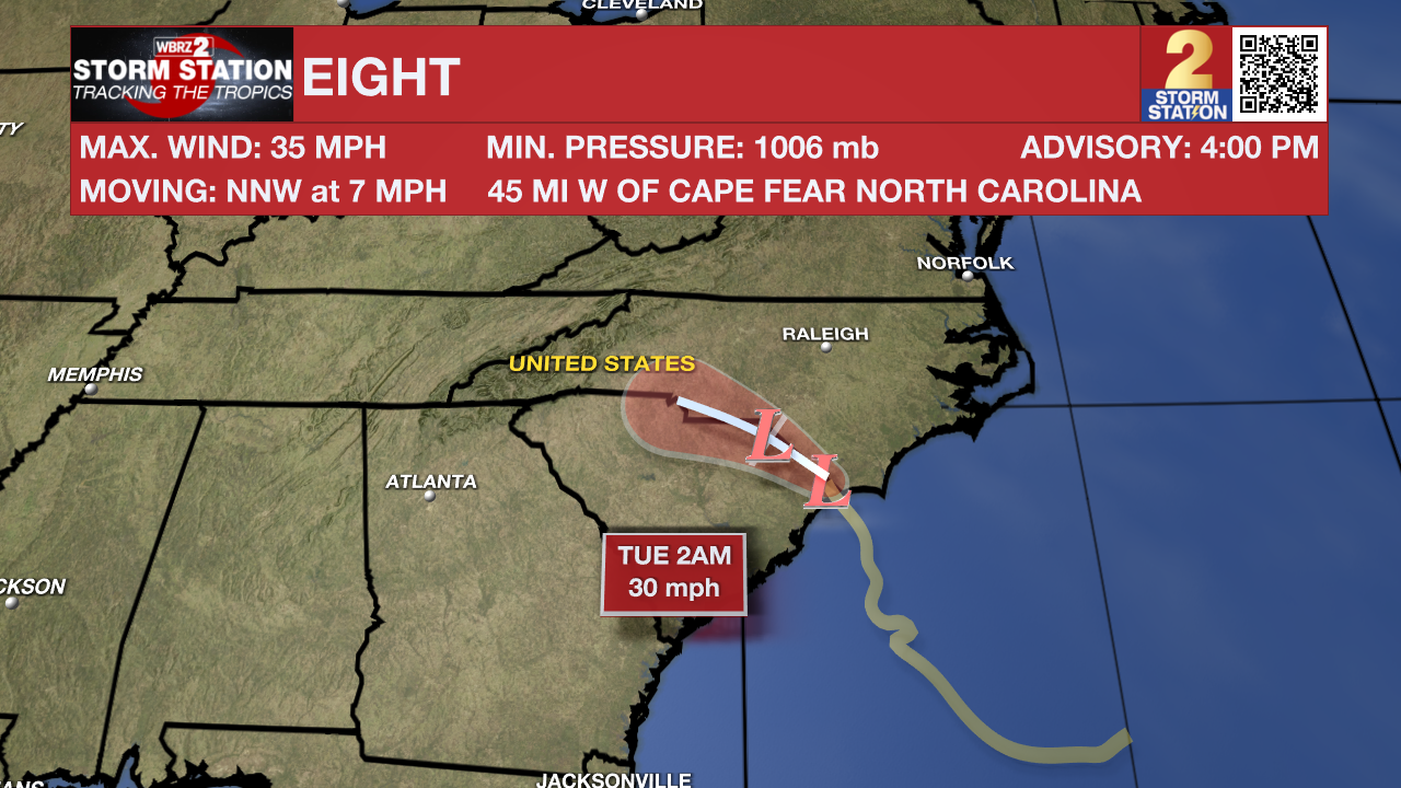
Potential Tropical Cyclone Eight continues to bring life threatening flash flooding and gusty winds to North Carolina. The unorganized system will move inland across North Carolina tonight. While winds will continue to weaken below 35mph, the system will continue to dump torrential rain with additional amounts of 4-8 inches while some areas have already received that much. Higher than usual tides and surf will also batter the coast with some location already inundated with water.
– Josh
The Storm Station is here for you, on every platform. Your weather updates can be found on News 2, wbrz.com, and the WBRZ WX App on your Apple or Android device. Follow WBRZ Weather on Facebook and Twitter for even more weather updates while you are on the go.
More News
