

Latest Weather Blog
Monday AM Forecast: Triple digit heat all week, Debby weakens to a tropical storm
More heat alerts and triple digit heat will be the norm this week as drier air filtering into the state will shut off any source of rain and limit cloud development as well.
Today & Tonight: Monday morning temperatures before sunrise will reside in the upper-70's before quickly warming up throughout the morning to triple digit heat this afternoon. The Capital City will see an afternoon high temperature of 100° Monday under mostly sunny skies with very little to no rainfall. Humidity levels will be slightly lower than in previous weeks thanks to a push of drier air into the region, but heat index values will still remain in Heat Advisory criteria, topping out near 110° Monday afternoon. Continue to practice heat safety by prioritizing hydration, checking in on neighbors and making sure your pets are staying cool as well. Overnight, mostly clear skies will remain and temperatures slowly cool down to a warm 79°.
Up Next: With drier air in place for the majority of the workweek, humidity levels will be down but afternoon high temperatures will hit 100°+ each day. Heat alerts will accompany most days while any cooling rain will be almost impossible to come by during the workweek. The drier air will also limit cloud development during the week which will also add to the blazing hot conditions. With school starting back for most kids over the next several days, remember to send them with water bottles and highlight the importance of drinking water throughout the day.
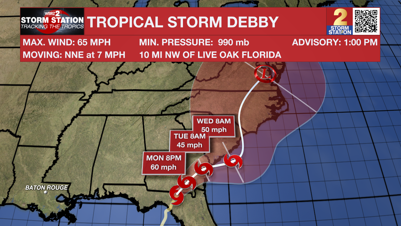
The Tropics: Debby made landfall in the Big Bend region of Florida early Monday as a Category 1 hurricane. The storm pushed inland through the morning, weakening to a tropical storm during that time. Debby will continue northeast through Georgia and the Carolinas in the coming days. As this happens, the storm's forward motion will slow to a crawl. This will produce major flooding over parts of Georgia and the Carolinas. Debby will not bring any direct impacts to Louisiana.
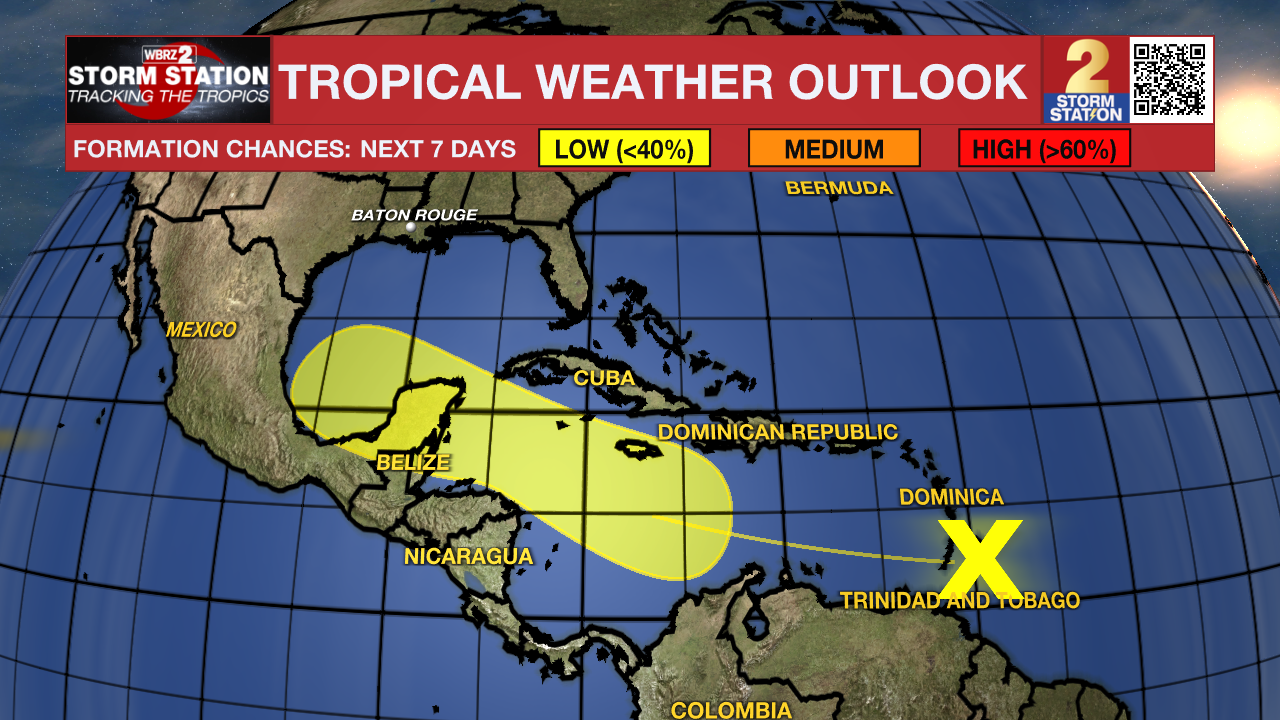
A tropical wave located a few hundred miles east of the Windward Islands continues to produce a disorganized region of thunderstorm activity. Conditions appear generally favorable for slow development over the next week as the system moves west at around 20 mph. The disturbance will cross the Windward Islands on Monday morning and then move into the central and western Caribbean by mid to late week.
Trending News
Get the latest 7-day forecast and real time weather updates HERE.
Watch live news HERE.
- Emma Kate C.
The Storm Station is here for you, on every platform. Your weather updates can be found on News 2, wbrz.com, and the WBRZ WX App on your Apple or Android device. Follow WBRZ Weather on Facebook and Twitter for even more weather updates while you are on the go.
More News
