

Latest Weather Blog
Monday AM Forecast: Last official week of summer features very seasonable conditions
The week leading up to the official first day of Fall on Sunday will feature typical late-summertime conditions. No major rainmaker can be found on the Storm Station 7-day forecast but an afternoon pop-up shower or two cannot be ruled out in the first half of the week.
Today & Tonight: Fog does not seem to be a huge threat Monday morning but a few isolated areas around the region may deal with patchy spots during the morning commute. Mostly clear skies early Monday will see a few more clouds by the afternoon hours. Temperatures will warm near average for mid-September this afternoon, near 90° in Baton Rouge. Winds will be light out of the northwest. With decent moisture in the atmosphere, a spotty shower or two cannot be ruled out today, although the best rain coverage remains near the coast.
Tonight, a spotty shower may be able to hang on after sunset due to an upper-level disturbance (associated with what's left over of Francine) pushing some additional moisture into the region. Even so, overall rain coverage remains limited. Temperatures will fall back into the lower-70's before sunrise Tuesday. Again, while not looking to be widespread, fog may be spotted on an isolated basis during the Tuesday morning commute.
Up Next: Slightly above average moisture on Tuesday could support isolated showers during afternoon hours. The area will otherwise be dry under partly sunny skies with a high near 90°. Wednesday through the weekend, rain chances dry up as a upper-level ridging moves east over the state. Each day will start off in the low-70's before warming near 90° during the day. Decent humidity remains present and winds will stay light.
Get the latest 7-day forecast and real time weather updates HERE.
Watch live news HERE.
Trending News
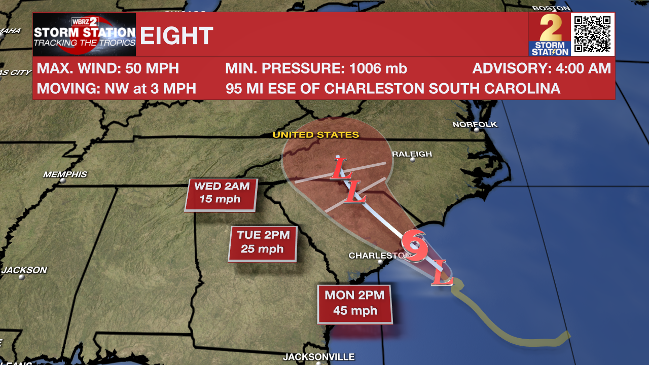
The Tropics: The National Hurricane Center began issuing advisories on Potential Tropical Cyclone Eight on Sunday afternoon. The "potential tropical cyclone" terminology is used when a disturbance does not meet the criteria to be a tropical depression or storm, but could do so and affect land within 48 hours. This allows the National Hurricane Center to begin issuing alerts and forecasts for the system well in advance of landfall. A Tropical Storm Warning has been issued along parts of the North and South Carolina coasts.
A tropical or subtropical storm could form today before the center of the storm moves inland over the Carolinas. If that happens, the system would take the name Helene. Regardless of any tropical or subtropical development, gusty winds, heavy rain, flooding, storm surge, and tornadoes are likely across portions of the U.S. Southeast and Mid-Atlantic coast. Fortunately, this storm will not be an issue for Louisiana.
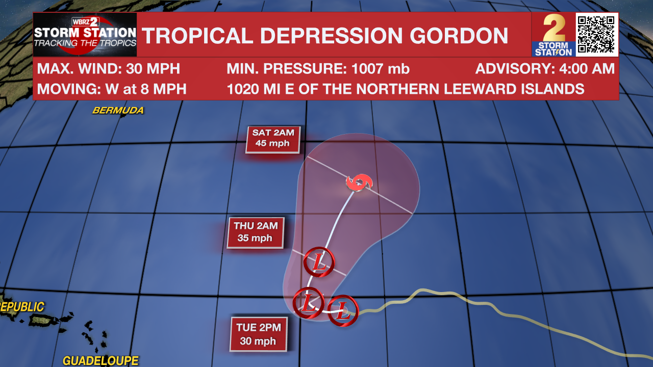
Gordon remains a Tropical Depression Monday. The latest forecast has the storm strengthening into a tropical storm by late week as it recurves out to sea. This storm will not pose a threat to land.
- Emma Kate C.
The Storm Station is here for you, on every platform. Your weather updates can be found on News 2, wbrz.com, and the WBRZ WX App on your Apple or Android device. Follow WBRZ Weather on Facebook and Twitter for even more weather updates while you are on the go.
More News
