

Latest Weather Blog
Friday PM Forecast: Perfect weather for homecoming weekend
Big weekend across the Capital Area and weather will be pleasant.
THE FORECAST
Tonight & Tomorrow: A couple of clouds in the skies this afternoon, but those will begin to fade out as we head into the overnight hours. Temperatures will cool off back into the 50s tonight. You will be waking up Saturday morning feeling comfortable. Humidity will be low and temperatures will be back more seasonable. Throughout the day temperatures are going to get on the warm side, with daytime highs topping out in the low-80s. Both LSU and Southern have their homecoming games this weekend and weather will be quiet. There will be a light southerly breeze but dew points stay low all day and no rain in the forecast. Into the evening hours any clouds will clear out and temperatures will drop back into the 60s.
Up Next: Sunday more of the same warm, dry pattern continues. More cloud cover is expected as southerly winds continue pumping moisture into the area. Daytime highs will be in the mid-80s but feeling closer to the high-80s with the added humidity. As the day goes on more cloud cover will begin to build in and temperatures will be in the high-60s overnight. Gradually we will see a warming trend in the forecast. Monday will be on the warm side with more cloud cover and Tuesday will be hot and humid as showers begin creeping in. Once the front pushes through into the evening hours on Tuesday we will be back feeling more like fall again. Click here to see the 7-day forecast.
Quick cold front moving through, do not let sneaky showers catch you off guard. The Storm Station has you covered with hour-by-hour weather tracking is available for your location on the WBRZ WX App on your Apple or Android device. Follow WBRZ Weather on Facebook and Twitter for even more weather updates and unique weather insight from the whole team!
In the Tropics:
Trending News
Area of potential development will NOT impact the local viewing area.
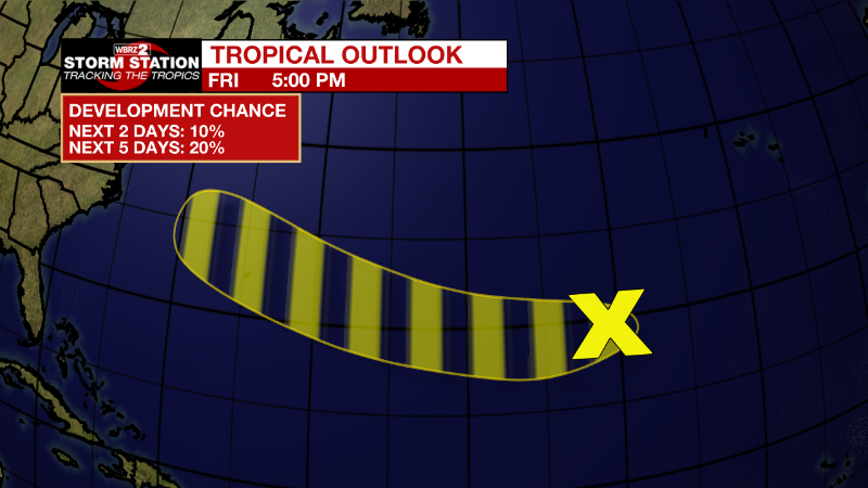
Eastern and Central Subtropical Atlantic:
A small non-tropical area of low pressure is located more than
1400 miles east of Bermuda. While this system is currently only
producing limited shower activity and environmental conditions are
only marginally favorable, recent satellite wind data indicates it
has maximum sustained winds near 40 mph. This low is forecast to
move quickly westward at 20-25 mph across the subtropical Atlantic
towards warmer waters, and could acquire some subtropical or
tropical characteristics by early next week. Additional information
on this system, including gale warnings, can be found in High Seas
Forecasts issued by the National Weather Service.
* Formation chance through 48 hours...low...10 percent.
* Formation chance through 5 days...low...20 percent.
More News
