

Latest Weather Blog
Friday PM Forecast: Near-record temperatures, with even hotter feels-like values
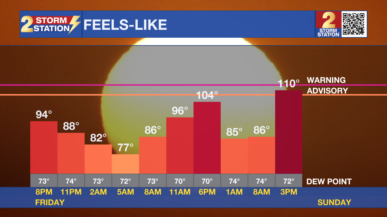
Near-record heat is coming to town over the weekend. Factor in the humidity, and feels-like temperatures will inch closer to Heat Advisory thresholds.
Tonight & Tomorrow: Any remaining afternoon showers will fizzle out into the evening with the loss of daytime heating. Skies will turn mainly clear for the overnight hours, allowing everyone to get a glimpse of the bright Full Moon. Look for an overnight low in the mid-70s.
Saturday will be a hot day. High temperatures will soar into the upper-90s in the capital area. The latest Storm Station forecast calls for a high near 98° in Baton Rouge, which is one degree shy of the record value. It will feel plenty muggy, with peak feels-like temperatures in the ballpark of 105-107°. Unfortunately, rain-cooling showers will be hard to find. A push of dry air will keep much of the region bone dry on Saturday.
Up Next: The capital region will see similar air temperatures on Sunday, but have an even hotter experience as the humidity nudges upward. This will push feels-like temperatures closer to 110° in some spots. Should this occur, this would surpass the threshold to warrant a Heat Advisory (feels-like 108°+). While the advisory has yet to be issued, the Storm Station still advises that everyone stay plenty hydrated and take it easy during the peaking heating hours this weekend - alert or not. Monday will be another scorcher, but indications point toward the heat scaling back by midweek. This will also coincide with the return of moisture and higher rain chances to the capital area.
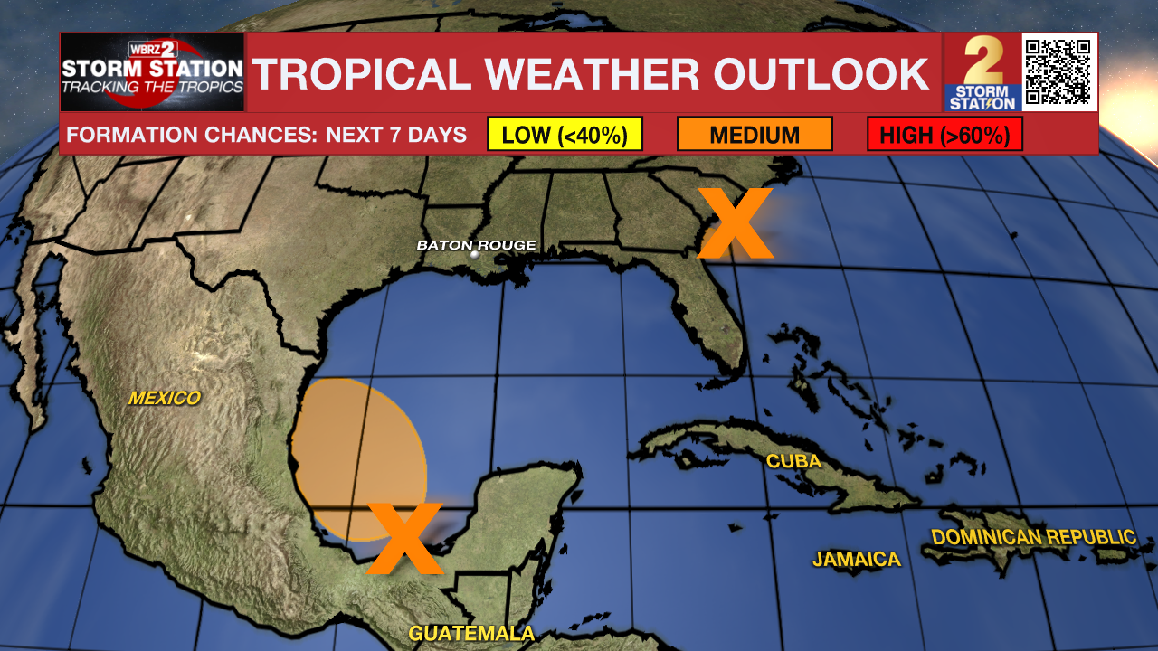
The Tropics: Satellite and radar imagery continue to show a lack of organization associated with a well-defined area of low pressure just off the Southeast Coast. However, a small increase in the amount of organization could result in a very short-lived tropical depression before reaching the the Florida/Georgia coast on Friday night. The system has a 40% chance of becoming a tropical depression before making landfall. This disturbance likely will not become Beryl, and it will bring no impacts to Louisiana.
Another area of low pressure will form over the Bay of Campeche on Friday night, in the footsteps of Alberto. Conditions appear favorable for gradual development of the system as it moves northwestward. A tropical depression could form on the southwest Gulf of Mexico over the weekend. As was the case with Alberto, the disturbance will be steered into Mexico.
Trending News
Get the latest 7-day forecast and real time weather updates HERE.
Watch live news HERE.
-- Meteorologist Malcolm Byron
The Storm Station is here for you, on every platform. Your weather updates can be found on News 2, wbrz.com, and the WBRZ WX App on your Apple or Android device. Follow WBRZ Weather on Facebook and Twitter for even more weather updates while you are on the go.
More News
