

Latest Weather Blog
Friday PM Forecast: humidity tumble may continue this weekend
Over the weekend, one more reinforcing shot of dry air will push into the region thanks to a weak front. Lower humidity will eliminate the need for heat alerts. The dry air will also keep rain chances close to nil through Sunday.
Tonight & Tomorrow: Another seasonable night is ahead. Thank a weak front which brought in a drier air mass and lowered humidity. As a result, low temperatures will settle close to average in the low 70s. The first half of the weekend will stay hot and dry. Abundant sunshine will push high temperatures into the upper 90s, but a heat advisory will not be needed thanks to lower humidity.
Up Next: Sunday will have one final shot of dry air to keep humidity low and the heat to a drier, more manageable level. It is not out of the question that some neighborhoods, especially north of I-12, wake up to thermometers in the upper 60s. The afternoon will be mostly sunny and hot. Any reprieve from the tropical humidity will be short lived. As a weak front dissipates over the region, Gulf of Mexico moisture will surge back inland. As another dome of hot air builds over the Gulf Coast, nasty feels-like temperatures are probable again next week. Our highs will hold steady in the upper 90s and lows will move back above average in the upper 70s. Still, rain is scarce on the Storm Station 7-Day Forecast.
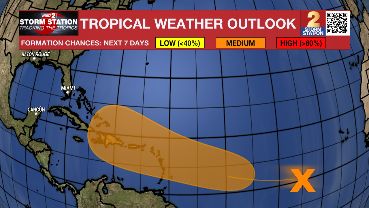
The Tropics: A large area of disorganized showers and thunderstorms located well to the west-southwest of the Cabo Verde Islands over the tropical Atlantic is associated with a tropical wave. Any development of the wave should be slow to occur during the next couple of days while it moves westward to west-northwestward across the central tropical Atlantic. Conditions are expected to become more conducive for development thereafter, and a tropical depression could form by early next week while the system approaches and then moves near or over the Lesser Antilles. The system is forecast to continue moving generally west-northwestward and could approach portions of the Greater Antilles by the middle part of next week.
Trending News
Get the latest 7-day forecast and real time weather updates HERE.
Watch live news HERE.
– Josh
The Storm Station is here for you, on every platform. Your weather updates can be found on News 2, wbrz.com, and the WBRZ WX App on your Apple or Android device. Follow WBRZ Weather on Facebook and Twitter for even more weather updates while you are on the go.
More News
