

Latest Weather Blog
Friday PM Forecast: hot weekend ends with scattered thunderstorms
Early this weekend, thermometers could reach their highest levels so far in 2024. 98 degrees was achieved on Memorial Day and also June 8. That number is the current forecast high for Saturday. Know that upper 90s and 100 degrees is unusually warm for Baton Rouge. Despite 32 days above the century mark in 2023, the Baton Rouge Area has only hit 100 in 29% of years since 1892. By the end of the weekend, chances for showers and thunderstorms will increase dramatically.
Tonight & Tomorrow: Mostly clear skies will continue through the overnight hours as low temperatures hover near average in the low 70s. In response to mostly sunny skies, an even hotter afternoon is expected on Saturday as high temperatures approach 100 degrees. With the heat, humidity will be somewhat in check, but enough will be there to push feels like temperatures close to 105 degrees.
Up Next: Humidity and moisture will increase more dramatically Saturday night into Sunday. With this, after highs achieve the low 90s, scattered showers and thunderstorms are expected to develop signaling the beginning of a more active weather pattern. If you have outdoor plans on Father’s Day, plan for some occasional indoor adjustments, but a washout is not anticipated.
Each day through the middle of the week will carry the possibility of scattered showers and thunderstorms, some of which could bring downpours. There is not a major concern for flooding, but summer thunderstorms are always capable of creating isolated pockets of poor drainage flooding. The wetter pattern will keep temperatures slightly below average. To pin down a most active, or wettest, day, Monday looks like the best bet. Through the middle of next week, 1-3 inches of rain is expected with isolated higher amounts.
Trending News
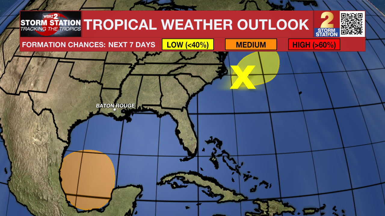
The Tropics: Satellite data and surface observations indicate that the low pressure area offshore of the southeastern U.S. coast is moving northeastward into the open Atlantic. This system is expected to merge with a front over the weekend, and the chances of tropical cyclone development are decreasing.
A broad area of low pressure is forecast to form over the southwestern Gulf of Mexico late this weekend or early next week. Environmental conditions appear conducive for gradual development of this system, and a tropical depression could form during the early or middle part of next week while it moves slowly westward or west-northwestward.
Get the latest 7-day forecast and real time weather updates HERE.
Watch live news HERE.
– Josh
The Storm Station is here for you, on every platform. Your weather updates can be found on News 2, wbrz.com, and the WBRZ WX App on your Apple or Android device. Follow WBRZ Weather on Facebook and Twitter for even more weather updates while you are on the go.
More News
