

Latest Weather Blog
Friday PM Forecast: chilly start to weekend, multiple fronts on the way
The weekend will start chilly but end mild. Multiple cold fronts will cross the area through the 7-Day Forecast.
Next 24 Hours: Clear skies and lighter winds will result in a chilly night across the Capital Area. Low temperatures will dip into the low 40s. A lot of sunshine and wind shifting southeasterly will send thermometers on a fast warming trend into Saturday. High temperatures will reach for the low 70s. For LSU fans spending time on campus, it will stay dry but a few layer changes may be needed with a cold morning, mild afternoon and temperatures easing back into the upper 50s at night.
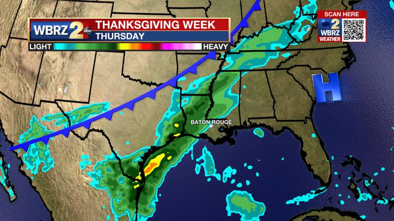
Up Next: Sunday will have morning lows in mid 50s and afternoon highs in the low 70s. Another cold front is pegged for Sunday night so clouds will increase through the day. There will be a short window of time for a couple of showers, primarily between dusk Sunday and dawn Monday. Then, clearing skies and an even cooler air mass will move in later Monday into Tuesday morning, as low temperatures could be frosty in the mid 30s again. The busy Thanksgiving travel day looks quiet locally but another storm system is expected toward the end of next week. Rain could return to the area by Thanksgiving night and last into Friday or even Saturday. CLICK HERE for your full 7-Day Forecast.
The Tropics: For the Gulf of Mexico, Caribbean Sea and North Atlantic, tropical development is not expected over the next five days. For the latest tropical forecasts, advisories and information, visit the WBRZ Hurricane Center as we finish out the 183 Days of Hurricane Season.
Trending News
The Explanation: As winds taper and skies stay clear Friday night into Saturday, temperatures will dip into the low 40s. The surface high moving east along with a zonal west to east jet stream will allow quiet conditions and near average temperatures through Sunday afternoon. The next upper level trough will try to basin in the Southeast U.S. early Monday and will send another fast-moving front through our area. Clouds will arrive Sunday afternoon with showers possible as early as Sunday evening but a lack of low level moisture ahead of it will prohibit well organized precipitation. A strong, arctic-based surface high will trail the front and depending how far south it drifts, temperatures could be quite chilly Monday afternoon into Wednesday morning. For now, the forecast readings are held at about 10 degrees below the seasonal averages of 70/46. Surface wind flow will turn back to southeasterly ahead of yet another approaching cold front on Thanksgiving. This moist flow will try to overcome the cool and dry air from Monday's front. Meanwhile, an upper level trough of low pressure and associated frontal system will approach our area potentially delivering some showers before the holiday ends.
--Josh
The WBRZ Weather Team is here for you, on every platform. Your weather updates can be found on News 2, wbrz.com, and the WBRZ WX App on your Apple or Android device. Follow WBRZ Weather on Facebook and Twitter for even more weather updates while you are on the go.
More News
