

Latest Weather Blog
Friday PM Forecast: as slim shower chances thin out, significant front awaits next week
The dreary weather around the region on Friday will gradually clear through the weekend. A strong fall front will press into the Metro Area by Monday evening inviting much drier, cooler air and shielding the coast from any tropical systems next week.
Tonight & Tomorrow: Mainly cloudy skies will stick around during the overnight hours. It is possible that a few showers hang on, especially near the coast, but this will be the exception rather than the rule. Low temperatures will be muggy in the low 70s. The weekend forecast has trended drier. While some showers remain possible on Saturday, especially south of I-10, those with outdoor activities should not fear any major disruptions. As clouds will be more dominant than sun, high temperatures will max in the upper 80s. Southern Jaguars football will kickoff to mostly cloudy skies and a temperature in the mid 80s.
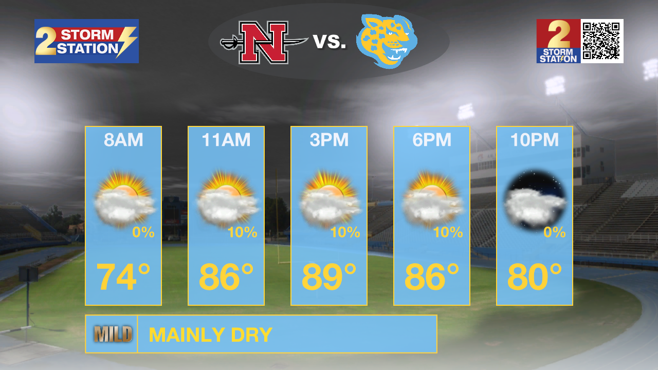
Up Next: Sunday looks even less likely to deal with any showers with partly sunny skies and highs near 90 degrees. On Monday, moisture will diminish as we await the arrival of a cold front. This front will push through during the evening hours followed by the coolest and driest air so far this season. Despite sunshine, high temperatures will stay in the mid 80s on Tuesday. By Wednesday morning, low temperatures will dip into the low 60s. Some spots north of the city could even reach the upper 50s for the first time this fall. The pleasant weather will likely have some staying power through the end of the workweek and likely even into next weekend.
Trending News
Get the latest 7-day forecast and real time weather updates HERE.
Watch live news HERE.
The Tropics: Major Hurricane Kirk continues churning across the open Atlantic Ocean with maximum sustained winds of 140mph. Though large swells from this system could reach the United States by Sunday, Kirk is a fish storm with a northwest motion becoming north and then northeast by next week as the storm loses strength and heads for Europe.

Following Kirk is Tropical Storm Leslie which is also gradually getting better organized. Maximum sustained winds of 65mph will intensify with a hurricane expected as the storm moves west and then northwest this weekend following Kirk out to sea.
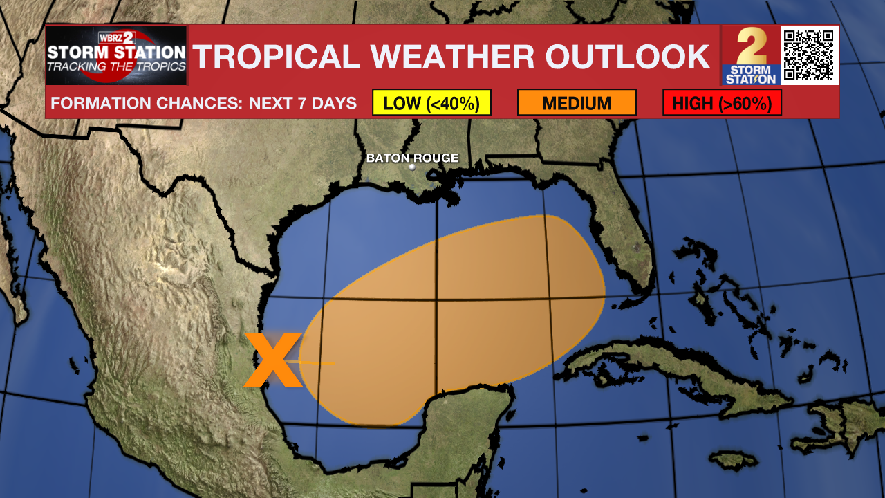
A trough of low pressure over the western Gulf of Mexico is producing widespread shower and thunderstorm activity. A broad area of low pressure is expected to develop from this system over the southwestern or south-central Gulf of Mexico during the next day or two, and additional subsequent development is possible while the low moves slowly eastward or northeastward. A tropical or subtropical depression or storm could form during the early to middle part of next week if the low remains separate from a frontal boundary that is forecast to extend across the Gulf of Mexico next week. Regardless of tropical or subtropical development, locally heavy rains could occur over portions of Mexico during the next few days and over portions of the Florida Peninsula late this weekend into next week.
– Josh
The Storm Station is here for you, on every platform. Your weather updates can be found on News 2, wbrz.com, and the WBRZ WX App on your Apple or Android device. Follow WBRZ Weather on Facebook and Twitter for even more weather updates while you are on the go.
More News
