

Latest Weather Blog
Friday AM Forecast: Drop in humidity makes hot weekend slightly more bearable
A *HEAT ADVISORY* is in effect from 10am to 7pm Friday for areas south of the Mississippi State Line, as feels-like temperatures over 108 degrees are expected. Hot temperatures will combine with moderate humidity and could possibly cause heat illnesses. Drink plenty of fluids, and when possible, stay in an air-conditioned rooms, avoid afternoon sun, and check up on relatives and neighbors.
Tonight & Tomorrow: Friday morning will feel very pleasant compared to the past few weeks. A shot of drier air that arrived over night will result in low to middle 70's for morning lows with less of the muggy "feel" that is typical for summertime months. Friday will be another scorcher of a day, with afternoon highs around the region heating into the upper-90's with mainly sunny skies and no rain to help cool off temperatures. While humidity levels have dropped, just enough moisture remains in the air today to allow heat index values to peak at 108°, calling for another Heat Advisory Friday. Overnight, under clear skies, temperatures will return to the middle 70's in the Capital Area.
Up Next: Into the weekend, a weak front will bring yet another push of dry air that will nudge humidity levels a bit lower for the entirety of the weekend. The dip in humidity will be most noticeable in the mornings, with lows each day in the low to mid-70's with less of the "muggy" feel. By Saturday and Sunday afternoons, the heat will kick into high gear with afternoon temperatures returning to the upper-90's each day. Good news is that the streak of heat alerts may be put to an end as slightly lower humidity will lower the heat-index values each afternoon. Any rain showers remain hard to come by over the weekend and no notable rainmaker can be spotted on the Storm Station 7-Day Forecast.
The Tropics: Post-Tropical Debby will continue to bring showers and storms to the New England area all weekend as the system works out the rest of it's energy and moisture.
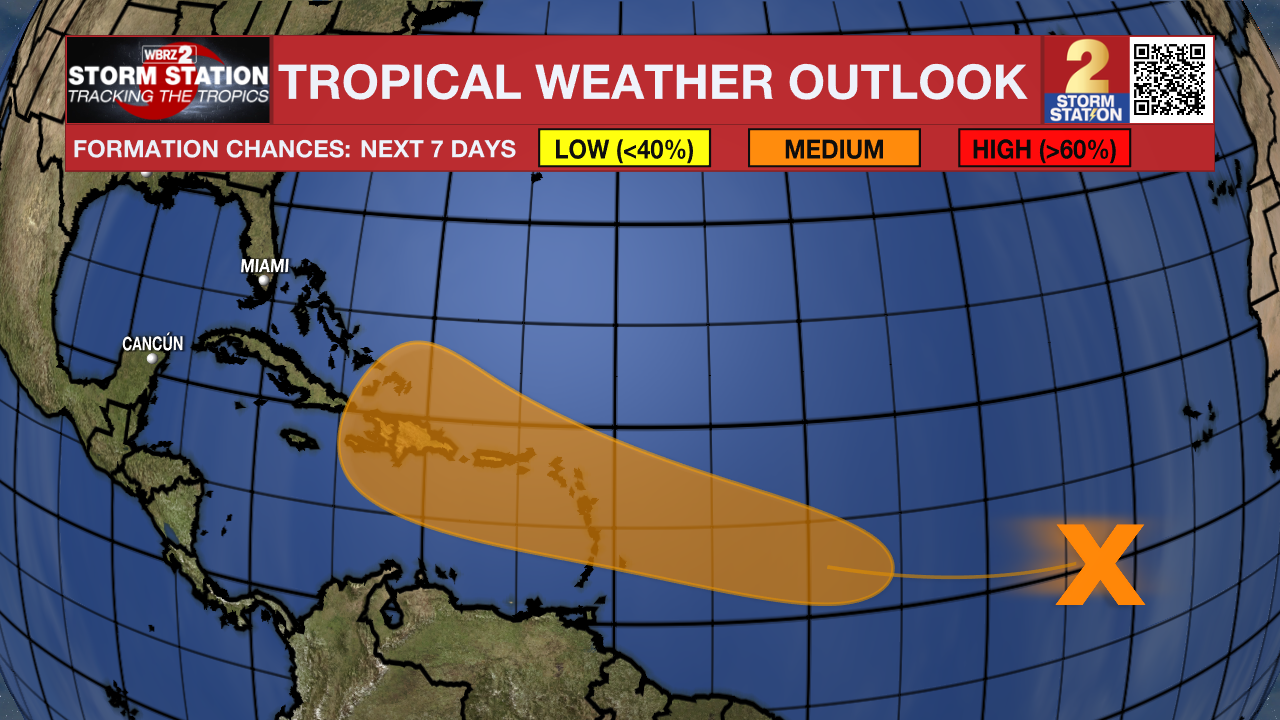
The next tropical wave located over the eastern tropical Atlantic is forecast to gradually become a bit more organized in the coming days. Conditions are expected to become more conducive for development early next week, and a tropical depression could form while it approaches the Lesser Antilles.
Trending News
Get the latest 7-day forecast and real time weather updates HERE.
Watch live news HERE.
– Emma Kate C.
The Storm Station is here for you, on every platform. Your weather updates can be found on News 2, wbrz.com, and the WBRZ WX App on your Apple or Android device. Follow WBRZ Weather on Facebook and Twitter for even more weather updates while you are on the go.
More News
