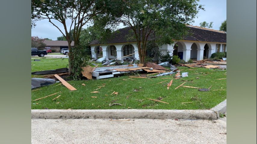
NWS confirms 2 tornadoes hit East Baton Rouge Wednesday morning
BATON ROUGE - The National Weather Service says two confirmed twisters touched down in East Baton Rouge Wednesday.
JUST IN: NWS confirms EF-0 tornado hit Greenwell Springs area of East #BatonRouge Parish on Wed. with maximum winds of 75mph. All damage was along Chicksaw Ave. #LaWX pic.twitter.com/f820sKWgvO
— Josh Eachus (@DrJoshWX) June 25, 2020
Along I-10 near Essen Lane, the National Weather Service found damage consistent with high end EF-1 with estimated winds at 110 mph. The path length is believed to have been 3.5 miles in length and 100 yards wide.
The most significant damage was in the vicinity of Ammon Staffing Building along I-10, where there was partial roof collapse and a vehicle tossed onto the interstate.
More shots of One Calais damage. Luckily this all happened before work day started and offices were open pic.twitter.com/a9YqbhhWDP
— Johnston von Springer (@johnstonvon) June 24, 2020Trending News
A second twister, an EF-0 with winds up to 75 miles per hour, hit the Greenwell Springs area around 5:30 a.m. Most of the damage in the area was limited to downed tree limbs, some of which landed on vehicles, and damaged fencing.
Early Wednesday morning, storms hit Baton Rouge, with the National Weather Service in New Orleans issuing a tornado warning for East Baton Rouge Parish and Northwestern Livingston Parish around 4:45 a.m., canceling it around 5:15 a.m. and then advising of a new warning at 5:40 a.m.
The short-lived warnings were due to the fact that the tornadoes themselves were short-lived and passed quickly. That said, officials say warnings like the ones issued Wednesday morning should still be taken seriously, as tornadoes of this nature can still cause extensive damage.
Firefighters in the capital city were kept busy throughout the early morning hours, assisting in numerous reports of fallen trees and limbs.
The St. George Fire Protection District reported responding to several storm-related incidents starting just before 5 a.m. Incident locations included I-10 at Essen, the Drusilla Lane area, and in locations along I-12 area where multiple trees had fallen.
>Click here for additional information on storm damage in Baton Rouge<
WBRZ's Chief Meteorologist Dr. Josh Eachus and his weather team will keep viewers updated on weather conditions on Channel 2 and WBRZ + as well as on Facebook and Twitter.
Tweets by WBRZweather


