

Latest Weather Blog
Dry stretch of weather, warming up
Tonight and Tomorrow: Tonight, skies will be partly cloudy. It will still be breezy at times, with winds out of the east 5 – 10 mph, occasionally as high as 15 mph. Lows will be in the low to mid 60s. Tomorrow, expect a repeat of Saturday. A mix of sun and clouds with highs in the mid 80s. Winds will be out of the east 5 - 15 mph, with gusts near 20 mph.
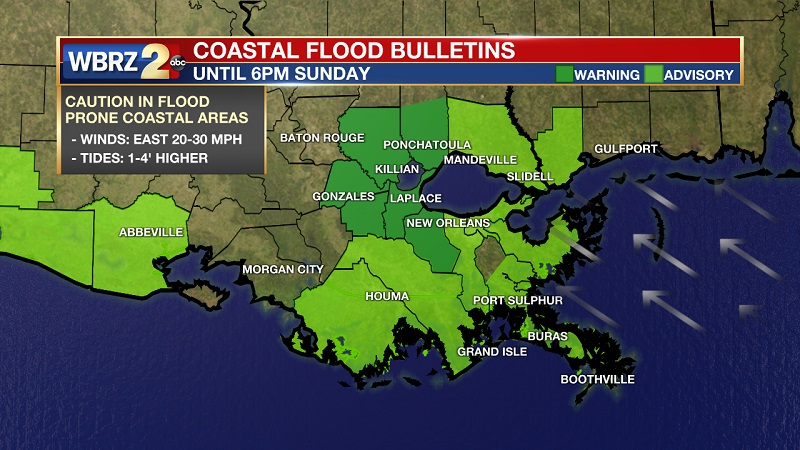
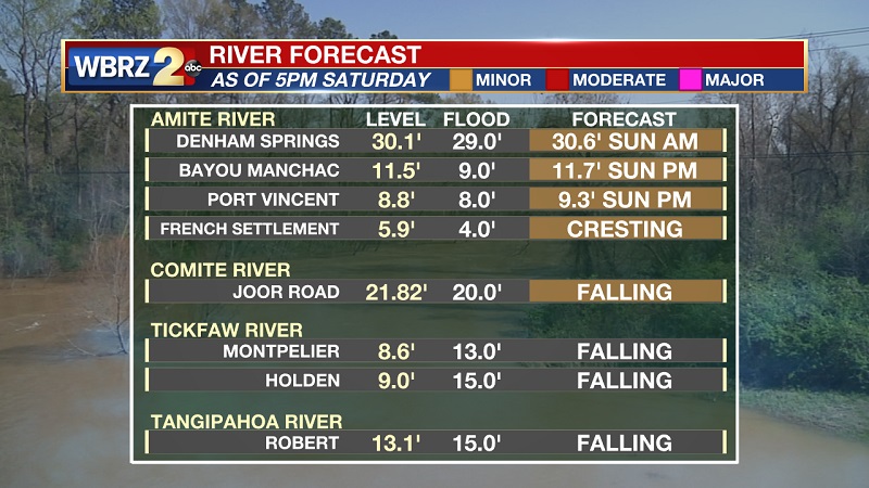
Looking Ahead: High pressure to the east will continue to build westward over the weekend. This is what will shield the rest of the rainfall back to our west over Texas. Our main focus going forward will be the remaining high creeks and rivers, as well as minor flooding on Lake Maurepas. Once the winds begin to slack off by early next week, water levels are expected to slowly come down. A Coastal Flood Warning remains in effect until Sunday evening for locations surrounding the tidal lakes.
Latest River Levels Updated Saturday PM:
Latest Creek Levels Updated Saturday PM:
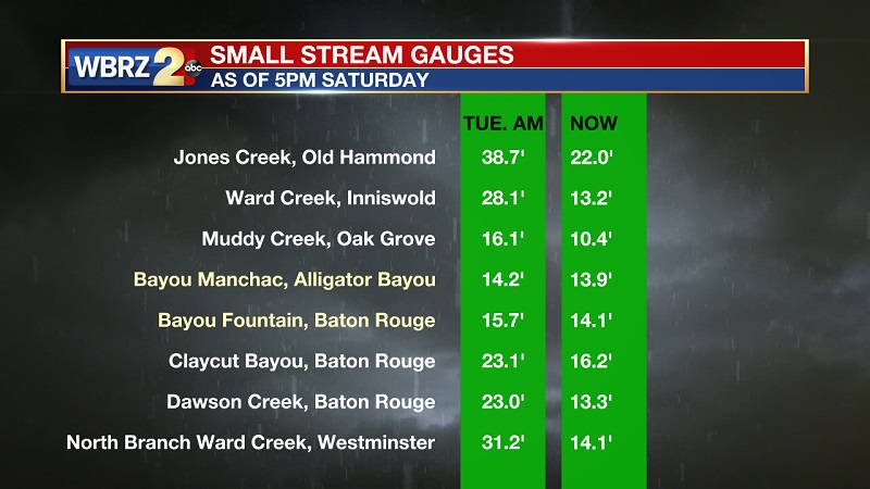
For more information on the impacts you could expect near these locations, CLICK HERE and then click on the river gauge site of interest.
The Tropics:
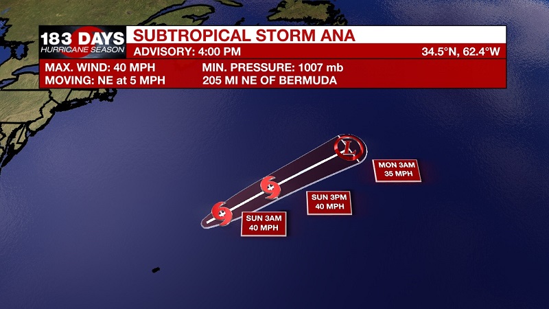
Subtropical Storm Ana has developed in the Atlantic, near Bermuda, becoming the first named storm of the 2021 Atlantic hurricane season. This system will NOT impact the United States and is forecast to remain out to sea.
-- Meteorologist Jake Dalton
More News
