

Latest Weather Blog
Part of the Atlantic is cooling, what this could mean for hurricanes
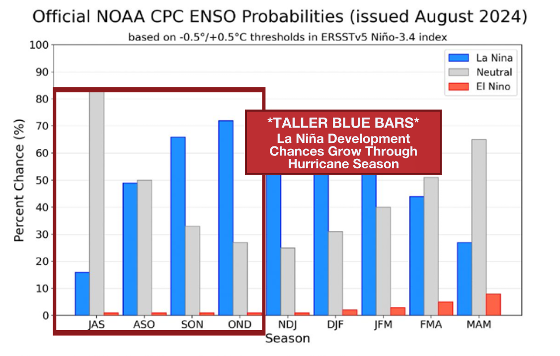
Recent outlooks for the 2024 Atlantic hurricane season have called for an extremely active season. Forecasters cite near-record warm ocean waters and a developing La Niña as reasons for the high number of projected storms.
While overall activity is predominately determined by these variables, there is another feature of interest. A region of cooler water along the Equator in the eastern Atlantic has formed in the last several weeks.
Cool Tongue of Atlantic Water
The area in question is nowhere near the United States. Rather, it deals with a narrow corridor along the Equator near the African coast. Cooling of these waters during the summer months is not abnormal. Westward moving trade winds tend to increase in the summer as a narrow region of tropical thunderstorms migrates north. The interaction of those winds with the ocean water reduces some of the warmth. However, the tongue of cooler water can be more or less significant in any given year.
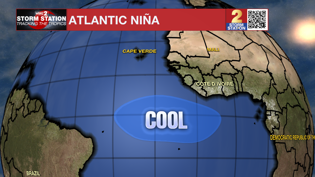
2024 began with incredibly warm ocean waters in the eastern Equatorial Atlantic, but a rapid transition to relatively cooler water was observed in June and July. In fact, this was the quickest transition in recorded history. Strangely, this cooling coincided with a weakening of trade winds, which would typically result in the opposite. The scientific community is unsure why this is happening. More research needs to be conducted to understand the event.
If these waters continue to cool, an “Atlantic Niña” might be declared. Similar to how a La Niña is an abnormal cooling of the waters in the Eastern Pacific along the Equator, an Atlantic Niña would be the Atlantic counterpart.
Trending News
Effect on the Atlantic Hurricane Season
The region that could experience the potential Atlantic Niña, with abnormally cool waters, lies along the Equator. This is not in the tropics where hurricanes form. There, the water is still quite warm.
Even so, research has shown that an Atlantic Niña tends to reduce precipitation of the Gulf of Guinea region of Africa. This in turn reduces the number of tropical waves coming off the African coast, potentially limiting the number of tropical cyclones.
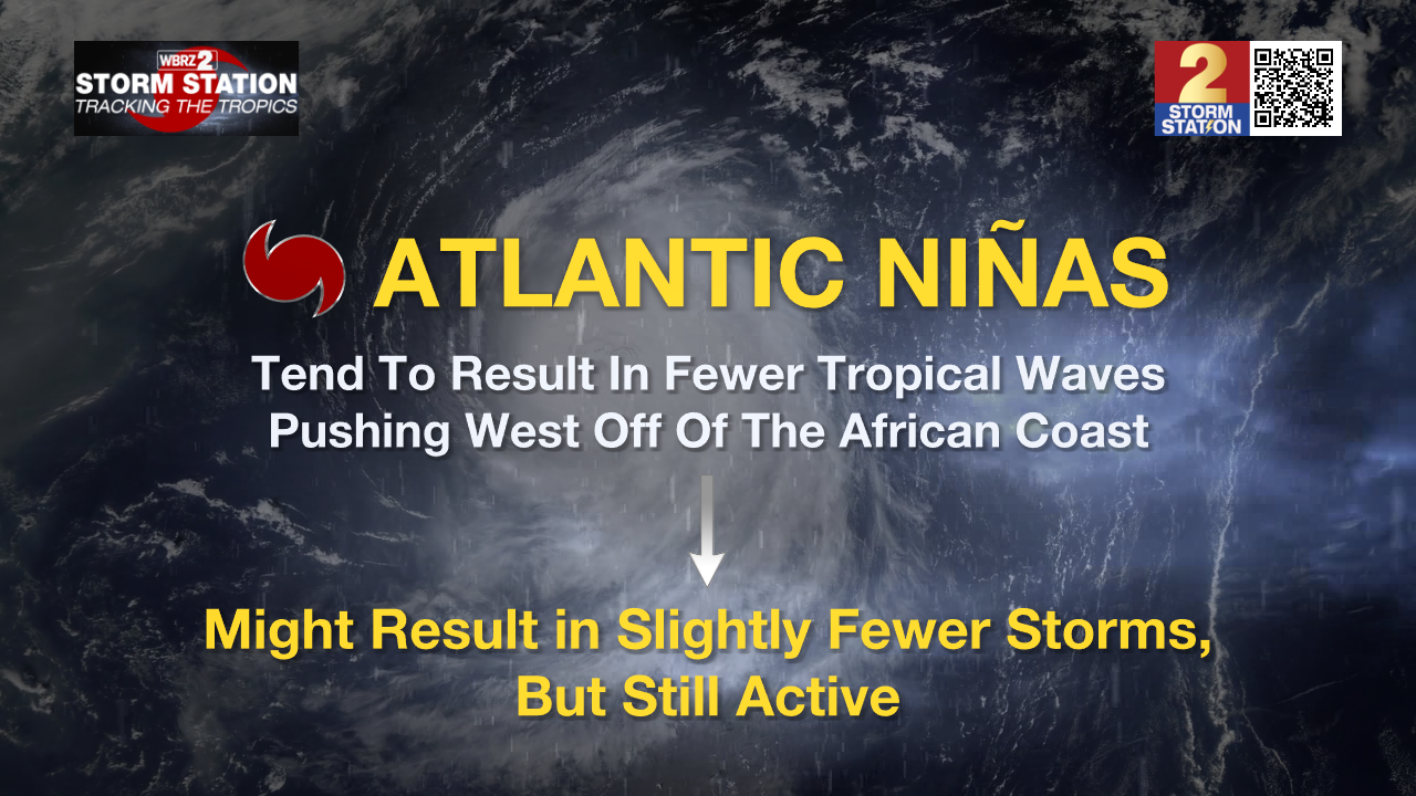
The opposite phenomenon, the Atlantic Niño, is linked to a higher number of African easterly tropical waves. This increases the likelihood of hurricane activity.
So the Atlantic Niño/Niña primarily affects hurricane development by regulating the number of tropical waves pushing off the African coast. However, it says nothing about tropical waves originating elsewhere – like the Caribbean Sea or Gulf of Mexico.
2024 Still Likely An Active Season
Even though the Atlantic Niño/Niña plays a role on influencing the development of hurricanes originating from the African coast, overall Atlantic activity is still predominately influenced by the classic El Niño or La Niña. It is more likely that the stage is set by El Niño and La Niña, and then adjusted by the Atlantic counterpart.
With a La Niña developing as peak hurricane season gets closer for 2024, this would favor an active season. However, an Atlantic Niña might pull back on what would otherwise be a hyperactive season. And this is if the Atlantic Niña truly develops; the jury is still out on that.
Active season or not, it only takes one landfalling storm to make it active for you. Now is a great time to make sure you’re prepared to act if a hurricane were to take aim at the state.
The Storm Station is here for you, on every platform. Your weather updates can be found on News 2, wbrz.com, and the WBRZ WX App on your Apple or Android device. Follow WBRZ Weather on Facebook and Twitter for even more weather updates while you are on the go.
More News
