

Latest Weather Blog
AIR QUALITY ALERT issued for Metro Area Wednesday, Storm Station tracking next round of active weather
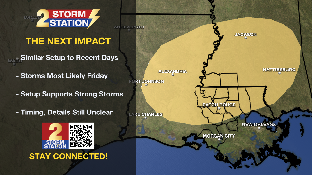
The Capital Area will take a break from severe weather for a few days. No rest for the weary though, another threat could materialize before the weekend.
Tonight & Tomorrow: Peaceful conditions will prevail overnight with mostly clear skies. Low temperatures will bottom out in the mid 60s. Wednesday will maintain a lot of sunshine with humidity still in check. High temperatures will soar to the low 90s.
An AIR QUALITY ALERT has been issued for the Metro Area on Wednesday. While the warmth will increase ground level ozone formation, wildfire smoke will ride into the region on northwesterly winds aloft. Much lighter winds at the surface will limit air dispersion and pollutants may build.
The Air Quality Index indicates that ozone will be at the orange level, which is Unhealthy for Sensitive Groups. Increasing ozone levels may cause unhealthy air quality during afternoon hours. Active children and adults, the elderly and people with respiratory diseases, such as asthma, should avoid prolonged outdoor activities and exertion. Several voluntary actions can help to reduce ozone formation such as driving less, refueling near dawn or dusk and conserving energy at home.
Up Next: Thursday will have a slightly warmer beginning in the upper 60s and have enough sunshine to push thermometers into the upper 80s. Clouds will thicken through the daytime hours, likely stopping most locations from reaching the 90s. As a warm front lifts inland across Louisiana, it could set off a few showers and thunderstorms, especially late. With warm and humid air in place, scattered to numerous showers and thunderstorms are expected on Friday. Very similar to the early week setup, a wave of energy may ride across a stalled front to trigger heavy, gusty thunderstorms. While it is a little far in advance to nail down specific times, Friday evening and night look most active.
Trending News
The front will weaken away from the area on Saturday but could have just enough identity left to pop a shower. Much more sunshine will be available though, and high temperatures will be pumped into the upper 80s. Sunday through Tuesday will be warm and muggy with highs near 90 and lows near 70s. Rain chances tuck back to about nil over the three day stretch.
Get the latest 7-day forecast and real time weather updates HERE.
Watch live news HERE.
– Josh
The Storm Station is here for you, on every platform. Your weather updates can be found on News 2, wbrz.com, and the WBRZ WX App on your Apple or Android device. Follow WBRZ Weather on Facebook and Twitter for even more weather updates while you are on the go.
More News
