

Latest Weather Blog
A heavy downpour possible before we dry out
A heavy downpour is possible with showers this afternoon.
THE FORECAST
Today & Tonight: Temperatures will heat up to 90 degrees with partly cloudy skies this afternoon. A few showers will pop up, mainly east of Baton Rouge in the warmest hours of the afternoon. Some of them may be efficient rainmakers and could drop 1-2 inches of rain in isolated locations. Otherwise, showers will be small and short-lived. Overnight it will be muggy with temperatures in the 70s.
Sun and Heat Safety: Some friendly reminders for your summer of fun events—sunburn can occur in less than 15 minutes with the extreme U.V. Index typical of this time of year. In addition to that, heat exhaustion and heat stroke can set in just as quickly. Seek medical attention if you or somebody you know is affected. While we all enjoy a list of cool beverages, be sure water is at least a part of that list! Finally, look before you lock. DO NOT leave people or pets in an unattended car.
Up Next: The dew point temperatures are telling the story. The air temperature can’t drop below the dew point, so that means while dew points are in the mid-70s, that’s as cold as it’s going to get. Morning for the rest of the week will be muggy with temperatures in the mid-70s every day. Each afternoon will be a little bit different. Thursday and Friday are trending drier with rain chances low. Drier conditions will lead to warmer temperatures, afternoon highs will be in the low 90s with high humidity. The heat index will be in the triple digits during the warmest afternoon hours and the UV index is hitting extreme levels. Be sure to practice good sun and heat safety. Into the weekend, hot, muggy, and a few showers will be back in the forecast on Sunday. Click here to see the 7-day forecast.
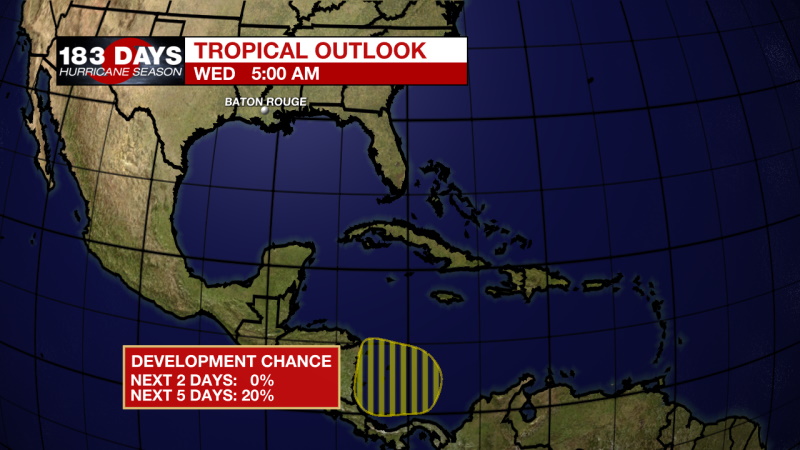
In the Tropics: An area of low pressure is expected to develop and move over the southwestern Caribbean Sea in the next few days. The development chance for the next 5 days is 20%. This system could bring heavy rainfall to parts of Central America. At this time, this is not a threat to the Gulf of Mexico. Click here to visit the WBRZ Hurricane Center.
Trending News
Need weather conditions HOUR BY HOUR? Get hour-by-hour weather and right now weather conditions for your location on the WBRZ WX App on your Apple or Android device. Follow WBRZ Weather on Facebook and Twitter for even more weather updates and unique weather insight from the whole team!
More News
