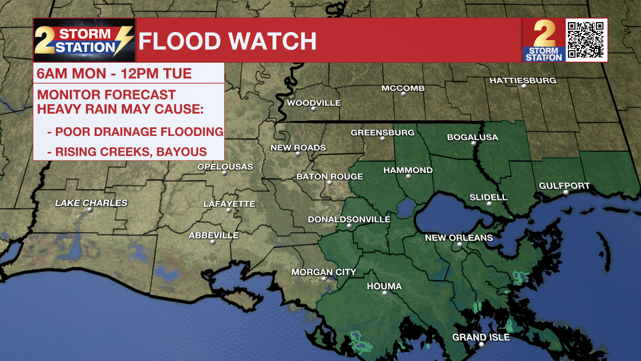
Flood Watch including parts of Capital Area ahead of several rounds of rain
The National Weather Service has issued a ***FLOOD WATCH*** for Ascension, Assumption, Livingston, St. James, and Tangipahoa Parishes. It will go into effect at 6 a.m. Monday and last through Noon Tuesday. A FLOOD WATCH means conditions may develop that lead to flash flooding. Flash flooding is a very dangerous situation. Be on the lookout for threatening weather conditions and listen for later statements and possible warnings. For more on flooding safety, CLICK HERE.
A slow-moving storm system will trigger several rounds of showers and thunderstorms across the state through Tuesday. Generally, 1-3" of rainfall are expected with locally higher amounts in spots. While not everyone will experience problems, those that see the heaviest rain could experience rainfall rates of 1-2" per hour. Should that occur, it could lead to street and poor drainage flooding in urban areas.

Tonight & Tomorrow: Off-and-on showers will continue through the evening hours, with scattered to numerous activity possible in the overnight hours. A few rumbles of thunder cannot be ruled out past dark in response to increasing instability as a warm front passes through. Temperatures will slowly climb from the middle to upper-60s on Sunday night after its passage.
Expect occasional showers at times on Monday. While the exact location remains unclear, an axis of heavy rain will set up somewhere in southeast Louisiana. It is not out of the question for it to do so in areas just to the east of Baton Rouge, such as Ascension, Livingston, and Tangipahoa. It is in this region that excessive runoff could result in nuisance standing water in common trouble spots, along with poor drainage flooding in urban settings. A Flood Watch will be in effect from 6 a.m. Monday to Noon Tuesday (see above) to account for this. Not all areas in the watch will experience problems. Rather, said axis of heavy rain will likely set up somewhere within the watch area. The heavy rain risk appears low near and northwest of the Capital City. Look for a high in the low to mid-70s on Monday.
Up Next: Another round of showers and thunderstorms will set up Monday night and into Tuesday. This time, it could occur closer to Baton Rouge. The rain will be on its way out on Tuesday night, leaving behind sunshine for midweek. However, another chill will accompany the sunshine. By Thursday morning, overnight lows will be in frost/freeze territory for many.
-- Meteorologist Malcolm Byron
Trending News
Remember that the WBRZ WX App. is *free* on Apple and Android devices and can be used for breaking weather information, live radar, and forecast details. You can also use it to watch live coverage if power or broadcast signal is ever lost. For even more, connect with the Storm Station on Twitter and Facebook. Stream WBRZ+ for continuous information as it becomes available.
Click HERE to watch WBRZ streaming live online


